MyTopo
Helps Michigan US Topo Map
Couldn't load pickup availability
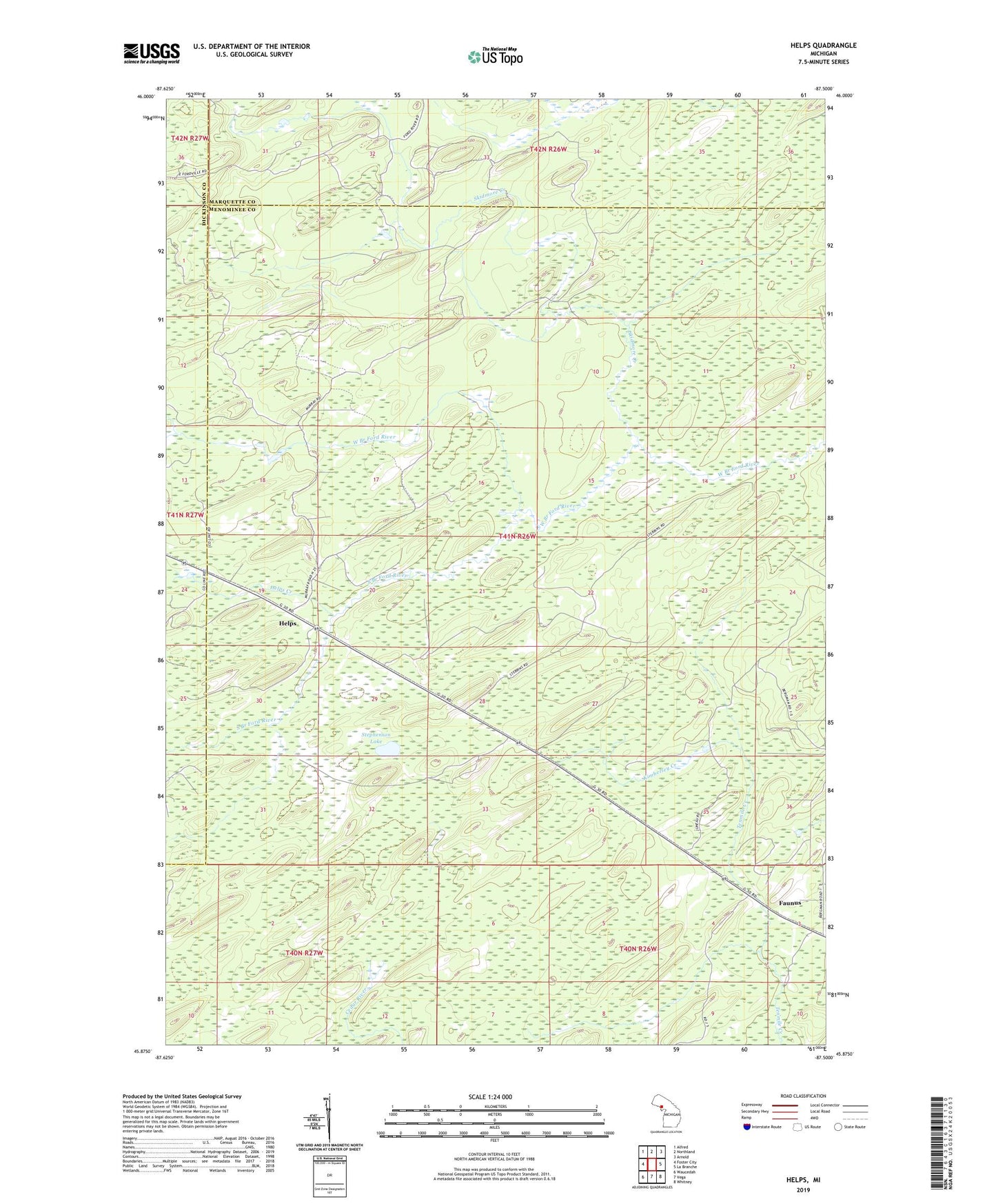
2023 topographic map quadrangle Helps in the state of Michigan. Scale: 1:24000. Based on the newly updated USGS 7.5' US Topo map series, this map is in the following counties: Menominee, Marquette, Dickinson. The map contains contour data, water features, and other items you are used to seeing on USGS maps, but also has updated roads and other features. This is the next generation of topographic maps. Printed on high-quality waterproof paper with UV fade-resistant inks.
Quads adjacent to this one:
West: Foster City
Northwest: Alfred
North: Northland
Northeast: Arnold
East: La Branche
Southeast: Whitney
South: Vega
Southwest: Waucedah
This map covers the same area as the classic USGS quad with code o45087h5.
Contains the following named places: Faunus, Faunus Post Office, Faunus Station, Helps, Helps Creek, Kimberley Creek, Skidmore Creek, South Branch Ford River, Stephenson Lake, ZIP Code: 49873