MyTopo
Gaastra Michigan US Topo Map
Couldn't load pickup availability
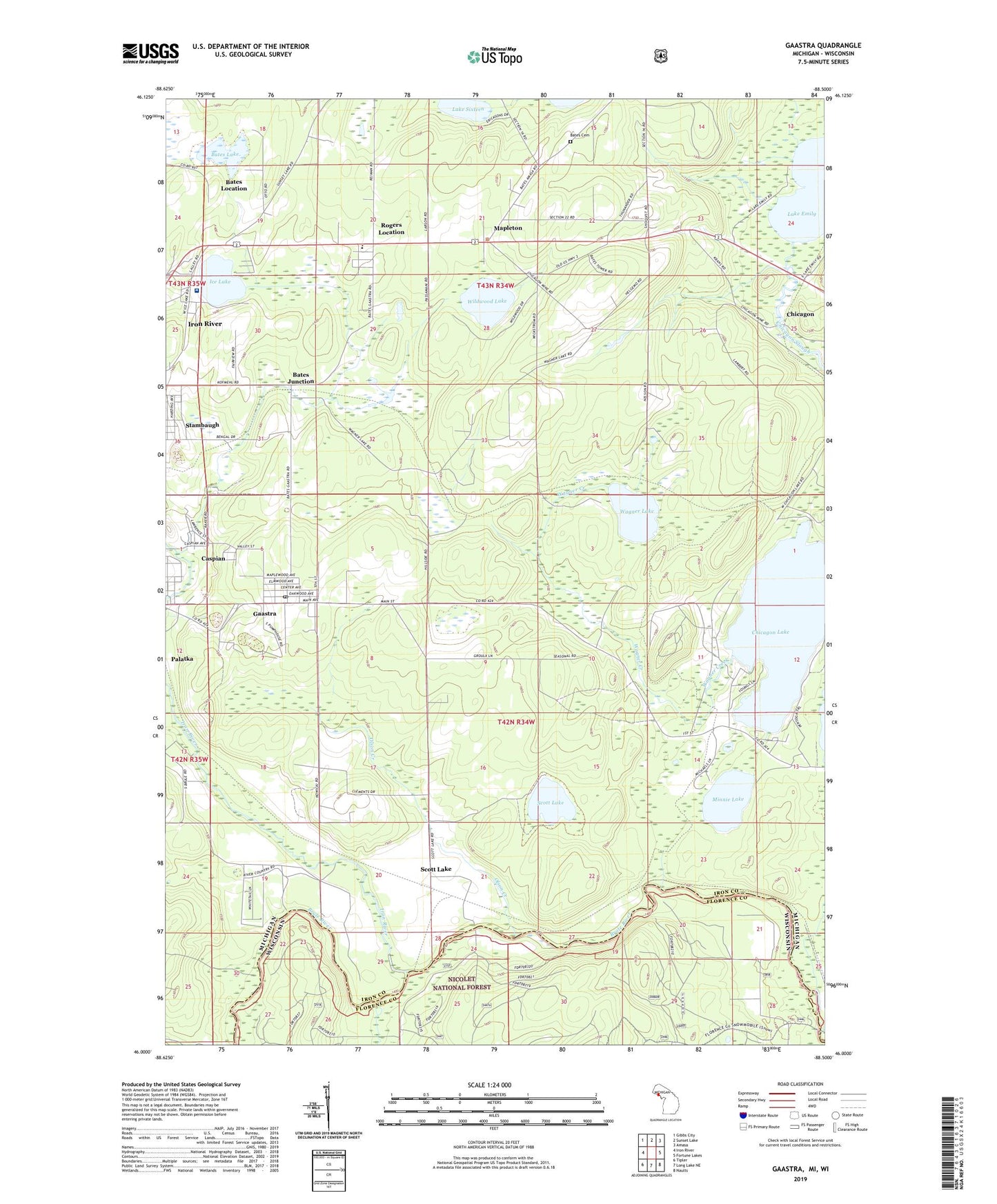
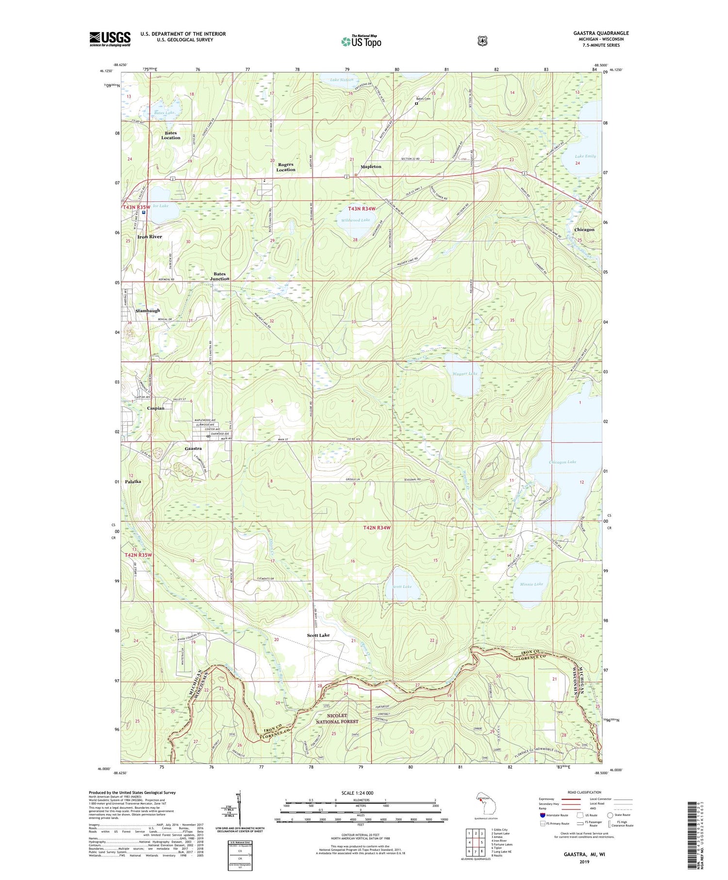
2019 topographic map quadrangle Gaastra in the states of Michigan, Wisconsin. Scale: 1:24000. Based on the newly updated USGS 7.5' US Topo map series, this map is in the following counties: Iron, Florence. The map contains contour data, water features, and other items you are used to seeing on USGS maps, but also has updated roads and other features. This is the next generation of topographic maps. Printed on high-quality waterproof paper with UV fade-resistant inks.
Quads adjacent to this one:
West: Iron River
Northwest: Gibbs City
North: Sunset Lake
Northeast: Amasa
East: Fortune Lakes
Southeast: Naults
South: Long Lake NE
Southwest: Tipler
Contains the following named places: Aspirus Iron River Hospital, Bates Cemetery, Bates Fire Tower, Bates Junction, Bates Lake, Bates Location, Bates Mine, Bates School, Bates Township Hall, Bengal Mine, Brule River Cliffs State Natural Area, Chicagon, Chicagon Lake, City of Gaastra, Edison School, First Roadside Park Historical Marker, Gaastra, Gaastra Police Station, Gaastra Post Office, George Young Golf Course, Ice Lake, Ice Lake Park, Indian Burial Ground, Indian Village Historical Marker, Iron County Community School, Iron River, Iron River Bible Church, Iron River Jehovah's Witnesses, Lake Emily, Lake Sixteen, Lakeland Baptist Church, Mapleton, Mapleton Post Office, Marquette Medical Clinic, Minnie Lake, Olson Creek, Palatka, Pentoga Park, Rogers Location, Rogers Mine, Saunders Post Office, Scott Lake, Scott Lake Station, Wagner Creek, Wagner Lake, WIKB-FM (Iron River), Wildwood Lake, Wisconsin Creek, ZIP Codes: 49915, 49927