MyTopo
Amasa Michigan US Topo Map
Couldn't load pickup availability
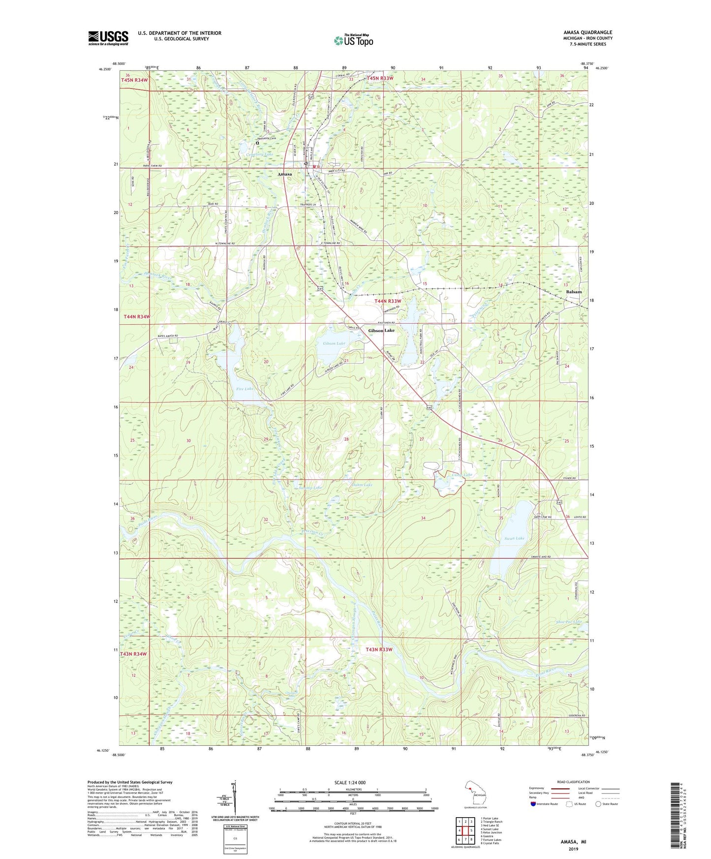
2023 topographic map quadrangle Amasa in the state of Michigan. Scale: 1:24000. Based on the newly updated USGS 7.5' US Topo map series, this map is in the following counties: Iron. The map contains contour data, water features, and other items you are used to seeing on USGS maps, but also has updated roads and other features. This is the next generation of topographic maps. Printed on high-quality waterproof paper with UV fade-resistant inks.
Quads adjacent to this one:
West: Sunset Lake
Northwest: Porter Lake
North: Triangle Ranch
Northeast: Ned Lake SE
East: Kelso Junction
Southeast: Crystal Falls
South: Fortune Lakes
Southwest: Gaastra
This map covers the same area as the classic USGS quad with code o46088b4.
Contains the following named places: Amasa, Amasa - Hematite Township Volunteer Fire Department, Amasa Census Designated Place, Amasa Community Library, Amasa Museum, Amasa Post Office, Amasa Station, Balsam, Balsam Post Office, Balsam Station, Bethany Lutheran Church, Camp Lake, Casagranda Race Track, Cedar Creek, Cemetery Lake, Chicagon Falls, Chicagon Slough, Dahm Lake, East Fork Premo Creek, Erickson Landing, Fire Lake, Fire Lake Creek, Gibson Lake, Gibson Lake Park, Gilbert Lake, Grace United Methodist Church, Gravel Pit Creek, Harrison Creek, Hematite Cemetery, Little Hemlock River, Manila Creek, Olson Creek, Peterson Creek, Porcupine Lake, Porter Mine, Premo Lake, Railroad Creek, Shoe Pac Lake, Sion Lutheran Church, Swamp Lake, Swan Lake, Warner Mine, Youngers Creek