MyTopo
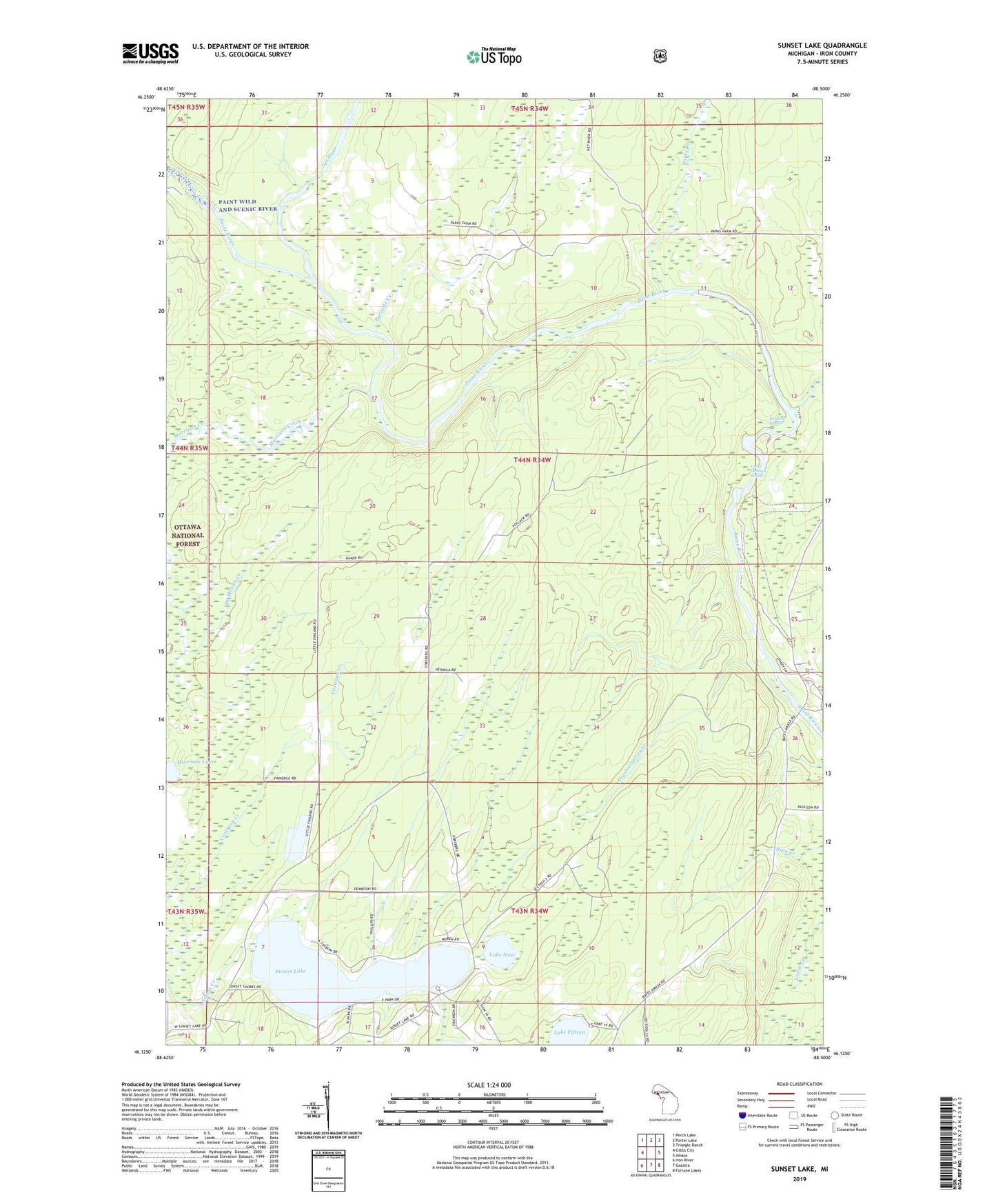
Sunset Lake Michigan US Topo Map
Couldn't load pickup availability
Also explore the Sunset Lake Forest Service Topo of this same quad for updated USFS data
2023 topographic map quadrangle Sunset Lake in the state of Michigan. Scale: 1:24000. Based on the newly updated USGS 7.5' US Topo map series, this map is in the following counties: Iron. The map contains contour data, water features, and other items you are used to seeing on USGS maps, but also has updated roads and other features. This is the next generation of topographic maps. Printed on high-quality waterproof paper with UV fade-resistant inks.
Quads adjacent to this one:
West: Gibbs City
Northwest: Perch Lake
North: Porter Lake
Northeast: Triangle Ranch
East: Amasa
Southeast: Fortune Lakes
South: Gaastra
Southwest: Iron River
This map covers the same area as the classic USGS quad with code o46088b5.
Contains the following named places: Barnetts Creek, Crystal Spring Creek, Finn Farm Creek, Hemlock Rapids, Hemlock River, Iron County, Lake Fifteen, Lake Nine, Lower Hemlock Rapids, Me-Squa-L-Cum-E Park, Morrison Creek, Morrison Lake, Net River, Paint Dam, Parks Creek, Sunset Lake, Sunset Lake Park