MyTopo
Garnet Michigan US Topo Map
Couldn't load pickup availability
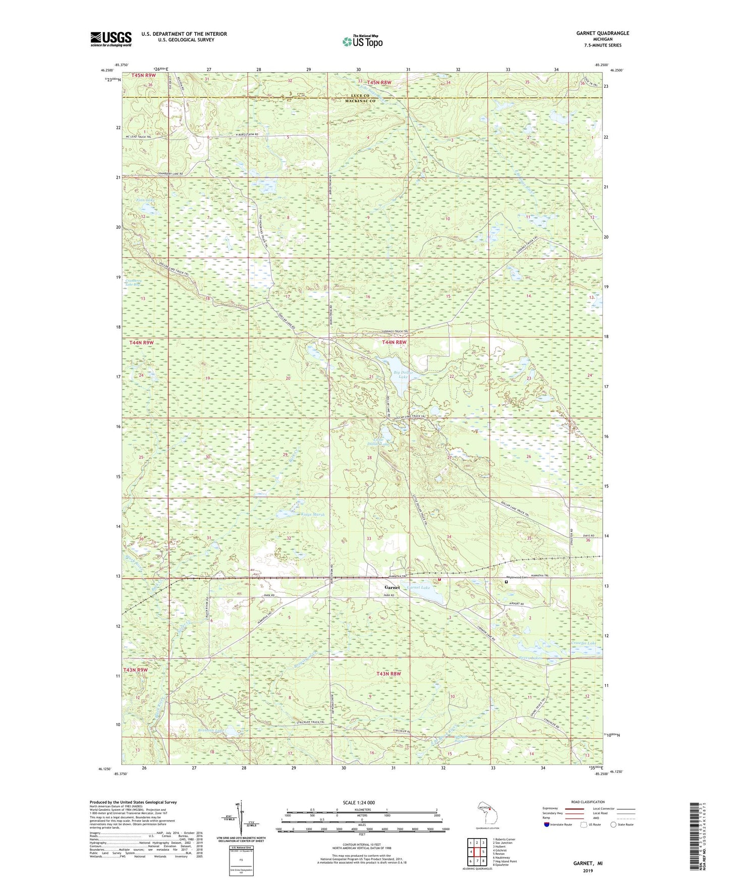
2019 topographic map quadrangle Garnet in the state of Michigan. Scale: 1:24000. Based on the newly updated USGS 7.5' US Topo map series, this map is in the following counties: Mackinac, Luce. The map contains contour data, water features, and other items you are used to seeing on USGS maps, but also has updated roads and other features. This is the next generation of topographic maps. Printed on high-quality waterproof paper with UV fade-resistant inks.
Quads adjacent to this one:
West: Gilchrist
Northwest: Roberts Corner
North: Soo Junction
Northeast: Hulbert
East: Rexton
Southeast: Epoufette
South: Hog Island Point
Southwest: Naubinway
Contains the following named places: Bark Creek, Big Dollar Lake, Brennan Lake, Crawfin Lake, Finn Lake, Garnet, Garnet Lake, Garnet Lake Campground, Garnet Post Office, Garnet Station, Hendricks Quarry Post Office, Hudson Township Fire Department, Hudson Township Park, Kings Marsh, Little Dollar Lake, Maplewood Cemetery, Seven Lakes, Silver Creek, Strickler Pond, Township of Hudson