MyTopo
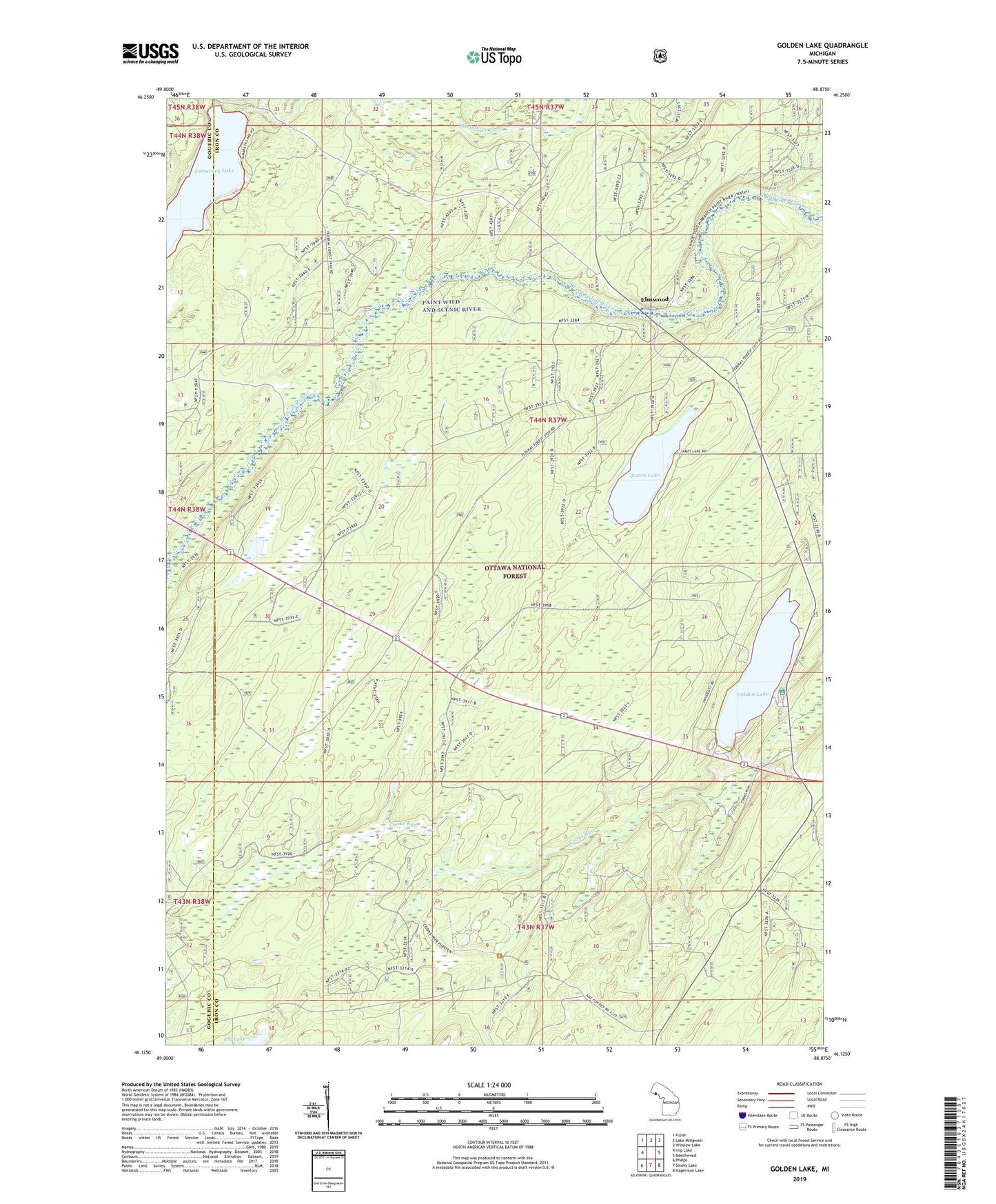
Golden Lake Michigan US Topo Map
Couldn't load pickup availability
Also explore the Golden Lake Forest Service Topo of this same quad for updated USFS data
2023 topographic map quadrangle Golden Lake in the state of Michigan. Scale: 1:24000. Based on the newly updated USGS 7.5' US Topo map series, this map is in the following counties: Iron, Gogebic. The map contains contour data, water features, and other items you are used to seeing on USGS maps, but also has updated roads and other features. This is the next generation of topographic maps. Printed on high-quality waterproof paper with UV fade-resistant inks.
Quads adjacent to this one:
West: Imp Lake
Northwest: Fuller
North: Lake Mitigwaki
Northeast: Winslow Lake
East: Beechwood
Southeast: Hagerman Lake
South: Smoky Lake
Southwest: Phelps
This map covers the same area as the classic USGS quad with code o46088b8.
Contains the following named places: Elk Lake, Elmwood, Elmwood Station, Elmwood Wayside, Fourth Creek, Fourth Lake, Golden Lake, Golden Lake Lookout Tower, Golden Lake Recreation Area, James Lake, Paintriver Post Office, Tamarack Lake, University of Michigan Forestry Camp