MyTopo
Lake Mitigwaki Michigan US Topo Map
Couldn't load pickup availability
Also explore the Lake Mitigwaki Forest Service Topo of this same quad for updated USFS data
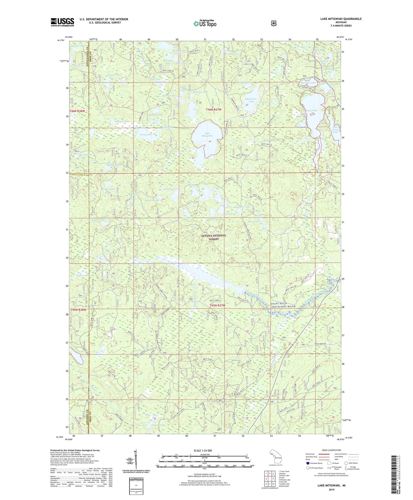
2023 topographic map quadrangle Lake Mitigwaki in the state of Michigan. Scale: 1:24000. Based on the newly updated USGS 7.5' US Topo map series, this map is in the following counties: Iron, Gogebic, Ontonagon. The map contains contour data, water features, and other items you are used to seeing on USGS maps, but also has updated roads and other features. This is the next generation of topographic maps. Printed on high-quality waterproof paper with UV fade-resistant inks.
Quads adjacent to this one:
West: Fuller
Northwest: Trout Creek
North: Kenton
Northeast: Glitter Lake
East: Winslow Lake
Southeast: Beechwood
South: Golden Lake
Southwest: Imp Lake
This map covers the same area as the classic USGS quad with code o46088c8.
Contains the following named places: Arc Lake, Arrow Lake, Avant Pond, Avaunt Pond, Bear Trap Dam, Bennett Lake, Buckeye Lake, Chief Edwards Lake, Clear Lake, Club Lake, Cranberry Lake, Curry Lake, Dragon Pond, East Paint Lake, Elinor Lake, Englesby Lake, Feeder Lake, Fisher Lake, Forest Lake, Hammer Lake, Harding Lake, Hehe Lake, Houser Lake, Johnson Lake, Killdeer Lake, Lake Mitigwaki, Madelyn Lake, Mallard Creek, Mallard Lake, Mallard Lake Lookout Tower, McPherson Lake, Mitigwaki Creek, Paint Creek, Paint Lake, Paw Lake, Plains Lake, Quiver Lake, Rabbitz Lake, Ripple Lake, Robinson Lake, Rock Lake, Rookery Lake, Roost Lake, Silk Lake, Skyline Lake, Spaulding Dam, Spree Lake, Tepee Creek, Thirtythree Creek, Tinsel Lake, Toots Lake, Trap Lake, Violet Lake, Whisper Lake