MyTopo
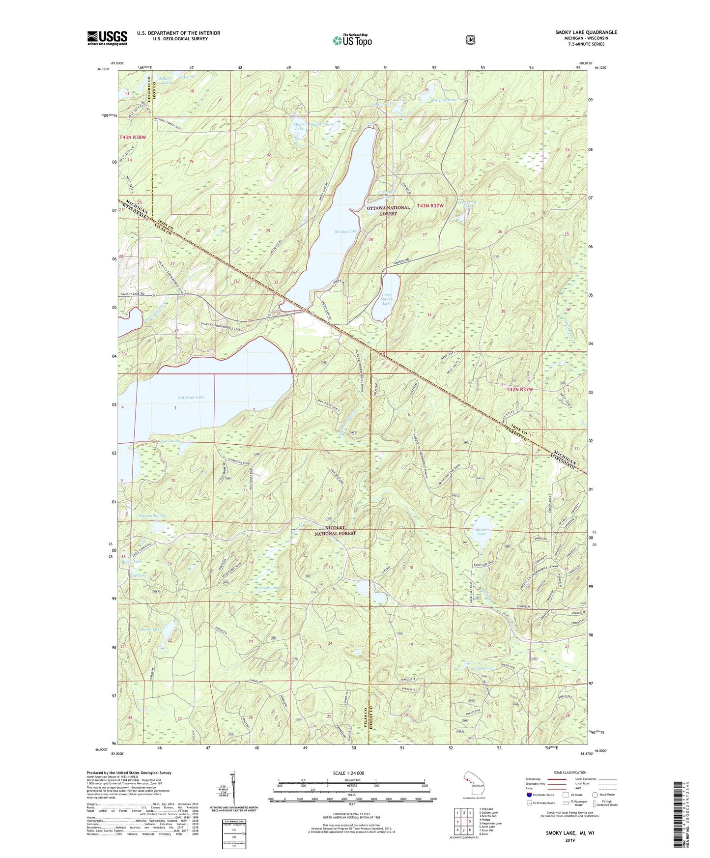
Smoky Lake Michigan US Topo Map
Couldn't load pickup availability
Also explore the Smoky Lake Forest Service Topo of this same quad for updated USFS data
2023 topographic map quadrangle Smoky Lake in the states of Wisconsin, Michigan. Scale: 1:24000. Based on the newly updated USGS 7.5' US Topo map series, this map is in the following counties: Iron, Vilas, Forest, Gogebic. The map contains contour data, water features, and other items you are used to seeing on USGS maps, but also has updated roads and other features. This is the next generation of topographic maps. Printed on high-quality waterproof paper with UV fade-resistant inks.
Quads adjacent to this one:
West: Phelps
Northwest: Imp Lake
North: Golden Lake
Northeast: Beechwood
East: Hagerman Lake
Southeast: Alvin
South: Alvin NW
Southwest: Anvil Lake
Contains the following named places: Bearpaw Lake, Big Sand Lake, Elvoy Springs, Gail Lake, Galpin Lake, Holmes Park, Horseshoe Lake, Ishkote Lake, Jewel Lake, Kaine Lake, Kentuck-Spectacle Lake Trail, Little Smoky Creek, Little Smoky Lake, Moose Lake, Phelps Municipal Landing Strip, Pickel Lake, Plymouth Lake, Porcupine Lake, Robinson Lake, Secret Lake, Smoky Lake, Squaw Lake