MyTopo
Goose Island Michigan US Topo Map
Couldn't load pickup availability
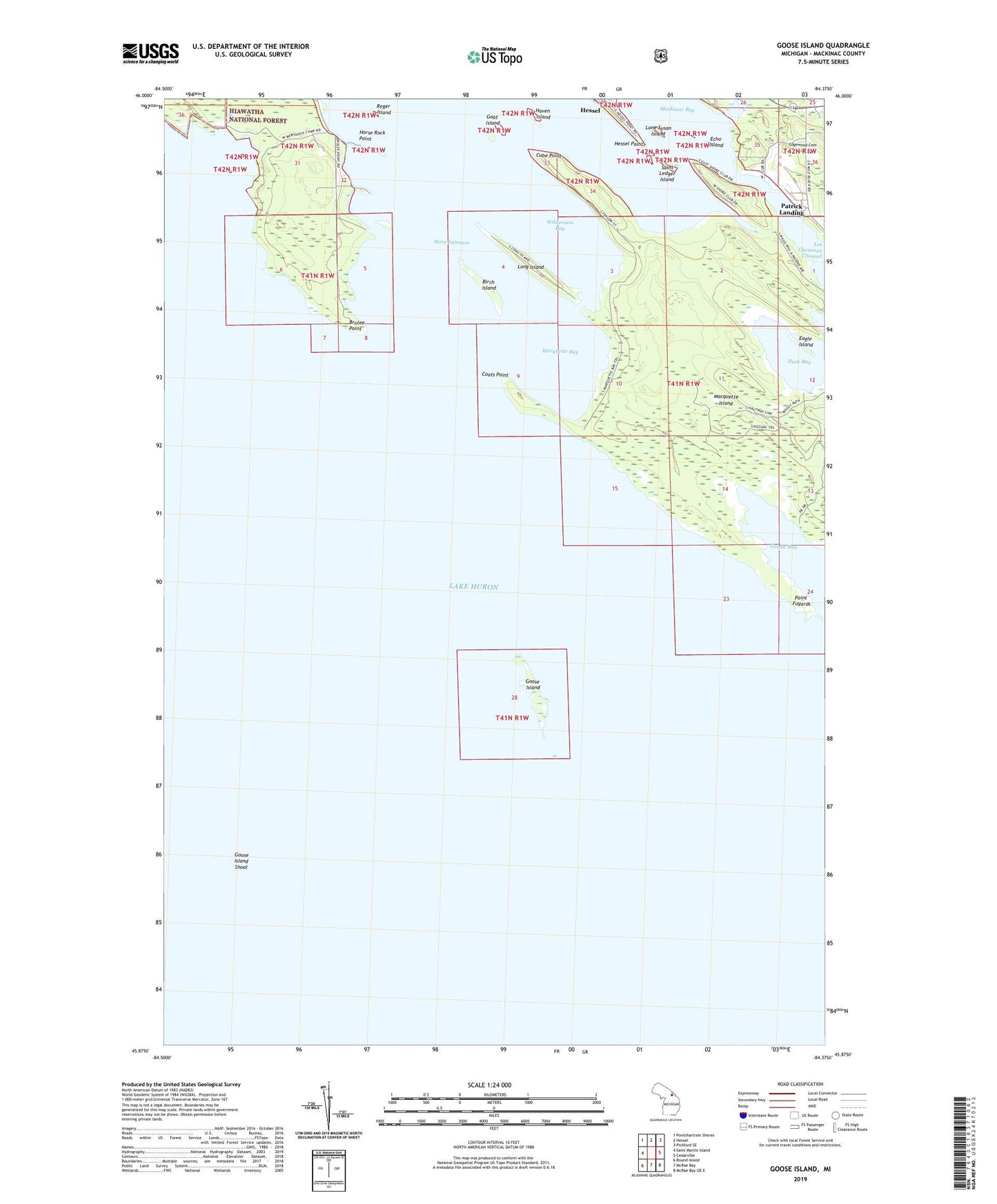
2019 topographic map quadrangle Goose Island in the state of Michigan. Scale: 1:24000. Based on the newly updated USGS 7.5' US Topo map series, this map is in the following counties: Mackinac. The map contains contour data, water features, and other items you are used to seeing on USGS maps, but also has updated roads and other features. This is the next generation of topographic maps. Printed on high-quality waterproof paper with UV fade-resistant inks.
Quads adjacent to this one:
West: Saint Martin Island
Northwest: Pontchartrain Shores
North: Hessel
Northeast: Pickford SE
East: Cedarville
Southeast: McRae Bay OE E
South: McRae Bay
Southwest: Round Island
Contains the following named places: Birch Island, Brulee Point, Coats Point, Cube Point, Dollar Island, Duck Bay, Eagle Island, Echo Island, Edgewood Cemetery, Goat Island, Goose Island, Goose Island Shoal, Haven Island, Hessel Point, Horse Rock Point, Les Cheneaux Channel, Les Cheneaux Club Post Office, Lone Susan Island, Long Island, Mackinac Bay, Marquette Bay, Marquette Island, Patrick Landing, Point Fuyards, Roger Island, Saint Ledger Island, Search Bay, Voight Bay, West Entrance, Wilderness Bay