MyTopo
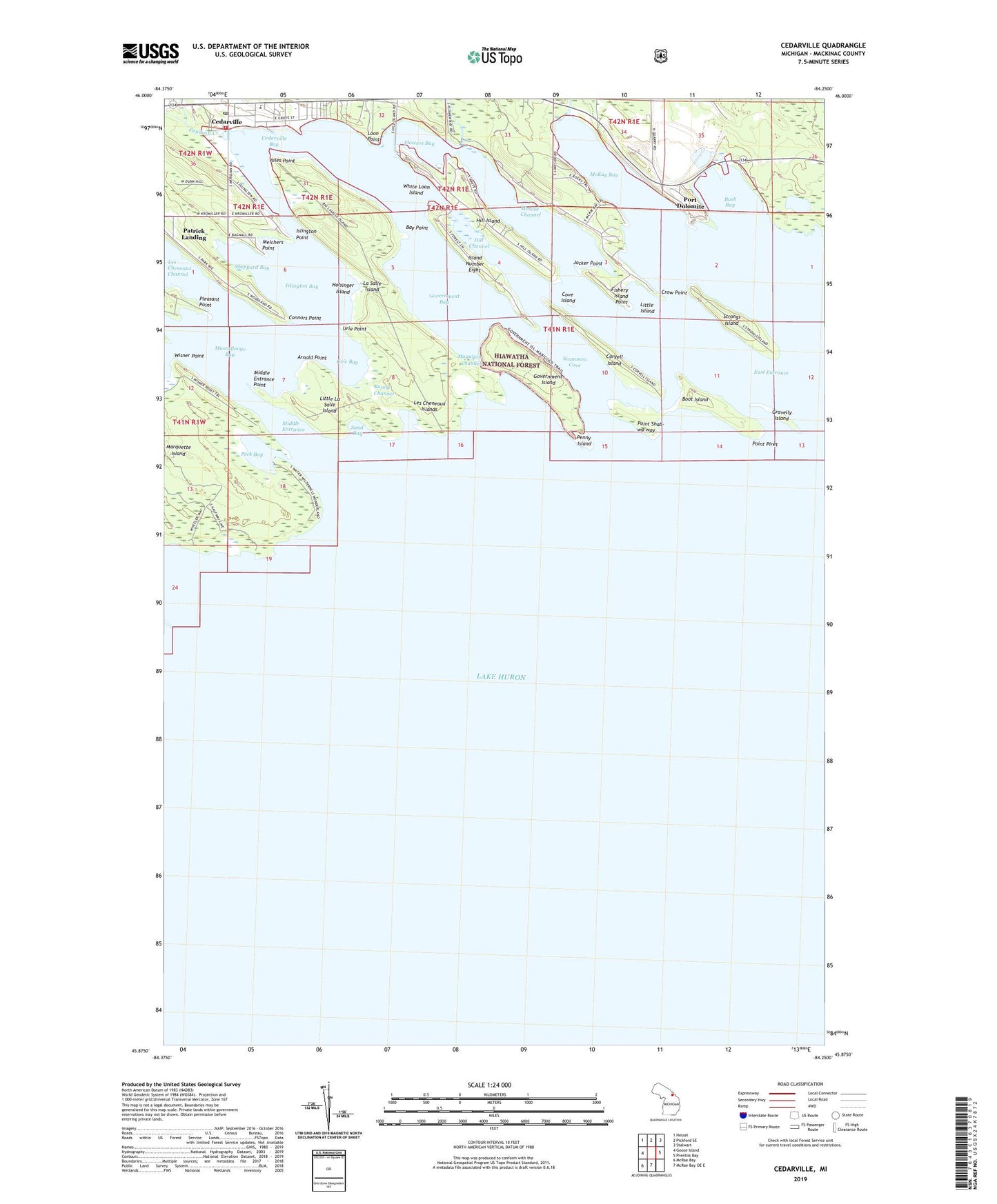
Cedarville Michigan US Topo Map
Couldn't load pickup availability
Also explore the Cedarville Forest Service Topo of this same quad for updated USFS data
2023 topographic map quadrangle Cedarville in the state of Michigan. Scale: 1:24000. Based on the newly updated USGS 7.5' US Topo map series, this map is in the following counties: Mackinac. The map contains contour data, water features, and other items you are used to seeing on USGS maps, but also has updated roads and other features. This is the next generation of topographic maps. Printed on high-quality waterproof paper with UV fade-resistant inks.
Quads adjacent to this one:
West: Goose Island
Northwest: Hessel
North: Pickford SE
Northeast: Stalwart
East: Prentiss Bay
South: McRae Bay OE E
Southwest: McRae Bay
This map covers the same area as the classic USGS quad with code o45084h3.
Contains the following named places: Ailes Point, Arnold Point, Bass Cove Lake, Bay Point, Beach Post Office, Boot Island, Bosely Channel, Bush Bay, Cedarville, Cedarville Bay, Cedarville Harbor Park, Cedarville Post Office, Cedarville RV Park and Campground, Clark Township Volunteer Fire Department, Connors Point, Coryell Island, Coryell Islands Post Office, Cove Island, Crow Point, East Entrance, First Union Church, Fishery Island Point, Flowers Bay, Flowers Creek, Government Bay, Government Island, Gravelly Island, Hill Channel, Hill Island, Holsinger Island, Hossack Memorial Park, Island Number Eight, Islington Bay, Islington Point, Islington Post Office, Jocker Point, La Salle Island, Lazy Days Campground, Les Cheneaux Community School, Les Cheneaux Historical Museum, Les Cheneaux Islands, Little Island, Little La Salle Island, Loon Point, Loons Point Campground, Magulpin Channel, Maritime Museum, McKay Bay, McKay Creek, Melchers Point, Middle Entrance, Middle Entrance Point, Moscoe Channel, Muscallonge Bay, Pearson Creek, Peck Bay, Penny Island, Pleasant Point, Point Piret, Point Shab-wa-way, Port Dolomite, Sand Bay, Scammon Cove, Sheppard Bay, Strongs Island, Urie Bay, Urie Point, White Loon Island, Wisner Point