MyTopo
Pickford SE Michigan US Topo Map
Couldn't load pickup availability
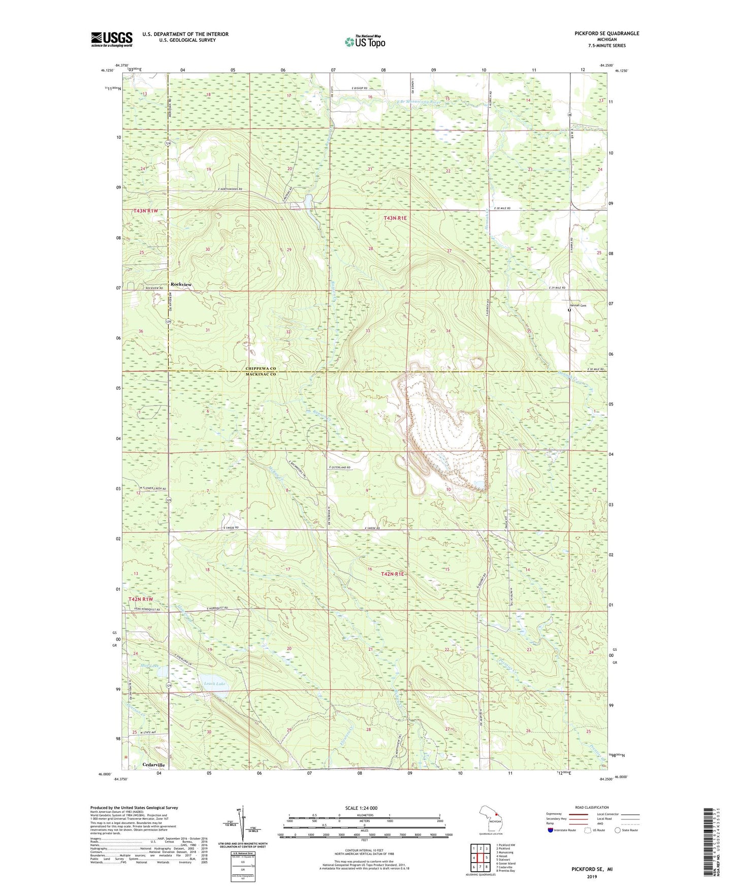
2023 topographic map quadrangle Pickford SE in the state of Michigan. Scale: 1:24000. Based on the newly updated USGS 7.5' US Topo map series, this map is in the following counties: Mackinac, Chippewa. The map contains contour data, water features, and other items you are used to seeing on USGS maps, but also has updated roads and other features. This is the next generation of topographic maps. Printed on high-quality waterproof paper with UV fade-resistant inks.
Quads adjacent to this one:
West: Hessel
Northwest: Pickford NW
North: Pickford
Northeast: Munuscong
East: Stalwart
Southeast: Prentiss Bay
South: Cedarville
Southwest: Goose Island
This map covers the same area as the classic USGS quad with code o46084a3.
Contains the following named places: Bethel Church, Hannah Cemetery, Hannah Creek, Leach Lake, Les Cheneaux Christian Fellowship, Mud Lake, Northwoods Camp, Rapson Creek, Rockview, Rockview Post Office, Township of Clark, ZIP Code: 49719