MyTopo
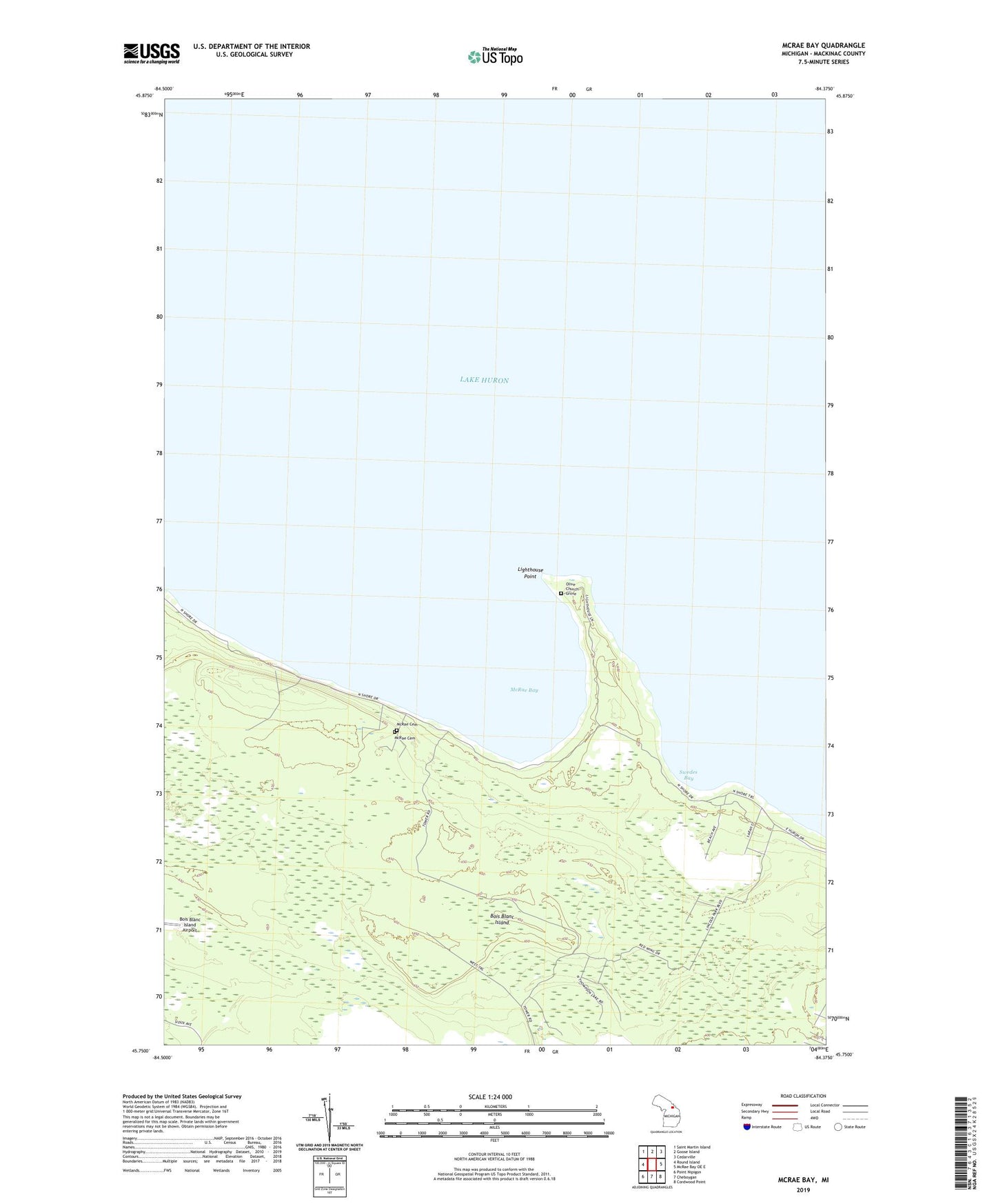
McRae Bay Michigan US Topo Map
Couldn't load pickup availability
2023 topographic map quadrangle McRae Bay in the state of Michigan. Scale: 1:24000. Based on the newly updated USGS 7.5' US Topo map series, this map is in the following counties: Mackinac. The map contains contour data, water features, and other items you are used to seeing on USGS maps, but also has updated roads and other features. This is the next generation of topographic maps. Printed on high-quality waterproof paper with UV fade-resistant inks.
Quads adjacent to this one:
West: Round Island
Northwest: Saint Martin Island
North: Goose Island
Northeast: Cedarville
East: McRae Bay OE E
Southeast: Cordwood Point
South: Cheboygan
Southwest: Point Nipigon
This map covers the same area as the classic USGS quad with code o45084g4.
Contains the following named places: Bois Blanc Island, Bois Blane Light, Boisblanc Post Office, Deer Lake, Evans Lake, Lake Mary, Lighthouse Point, Lost Lake, McRae Bay, McRae Cemetery, Olive Church Grove, Swedes Bay, Township of Bois Blanc, Twin Lake Creek, ZIP Code: 49775