MyTopo
Curtis East Michigan US Topo Map
Couldn't load pickup availability
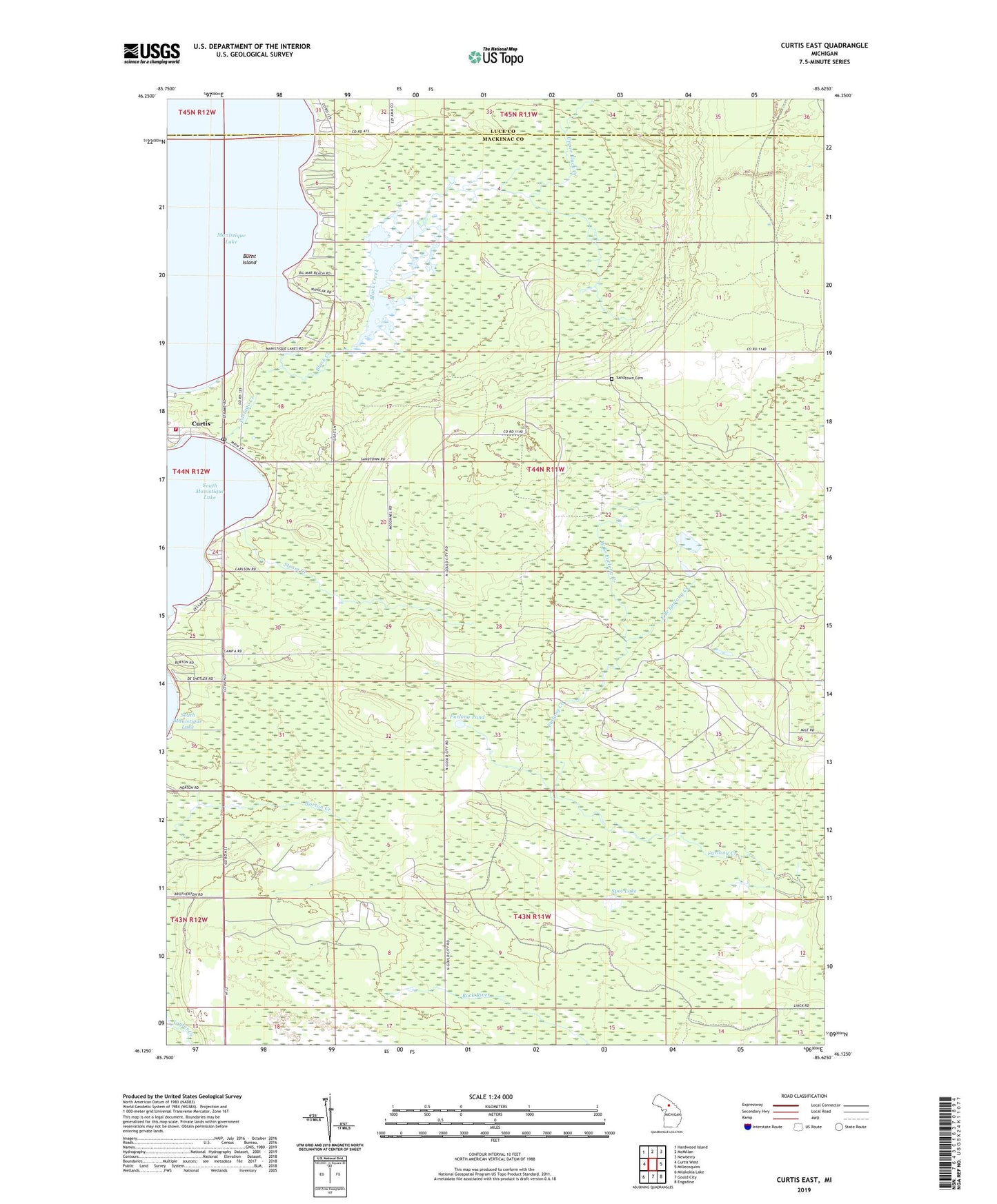
2023 topographic map quadrangle Curtis East in the state of Michigan. Scale: 1:24000. Based on the newly updated USGS 7.5' US Topo map series, this map is in the following counties: Mackinac, Luce. The map contains contour data, water features, and other items you are used to seeing on USGS maps, but also has updated roads and other features. This is the next generation of topographic maps. Printed on high-quality waterproof paper with UV fade-resistant inks.
Quads adjacent to this one:
West: Curtis West
Northwest: Hardwood Island
North: McMillan
Northeast: Newberry
East: Millecoquins
Southeast: Engadine
South: Gould City
Southwest: Milakokia Lake
This map covers the same area as the classic USGS quad with code o46085b6.
Contains the following named places: Black Creek, Black Creek Flooding, Burnt Island, Curtis, Curtis Baptist Church, Curtis Library, Curtis Post Office, East Branch Furlong Creek, Furlong Pond, Manistique Lake Family Clinic, Portage Creek, Portage Township Park, Portage Township Volunteer Fire Department, Sandtown Cemetery, Spot Lake, Strom Creek, Township of Portage, Upper Black Creek, West Branch Furlong Creek, Wildwood Church, ZIP Code: 49820