MyTopo
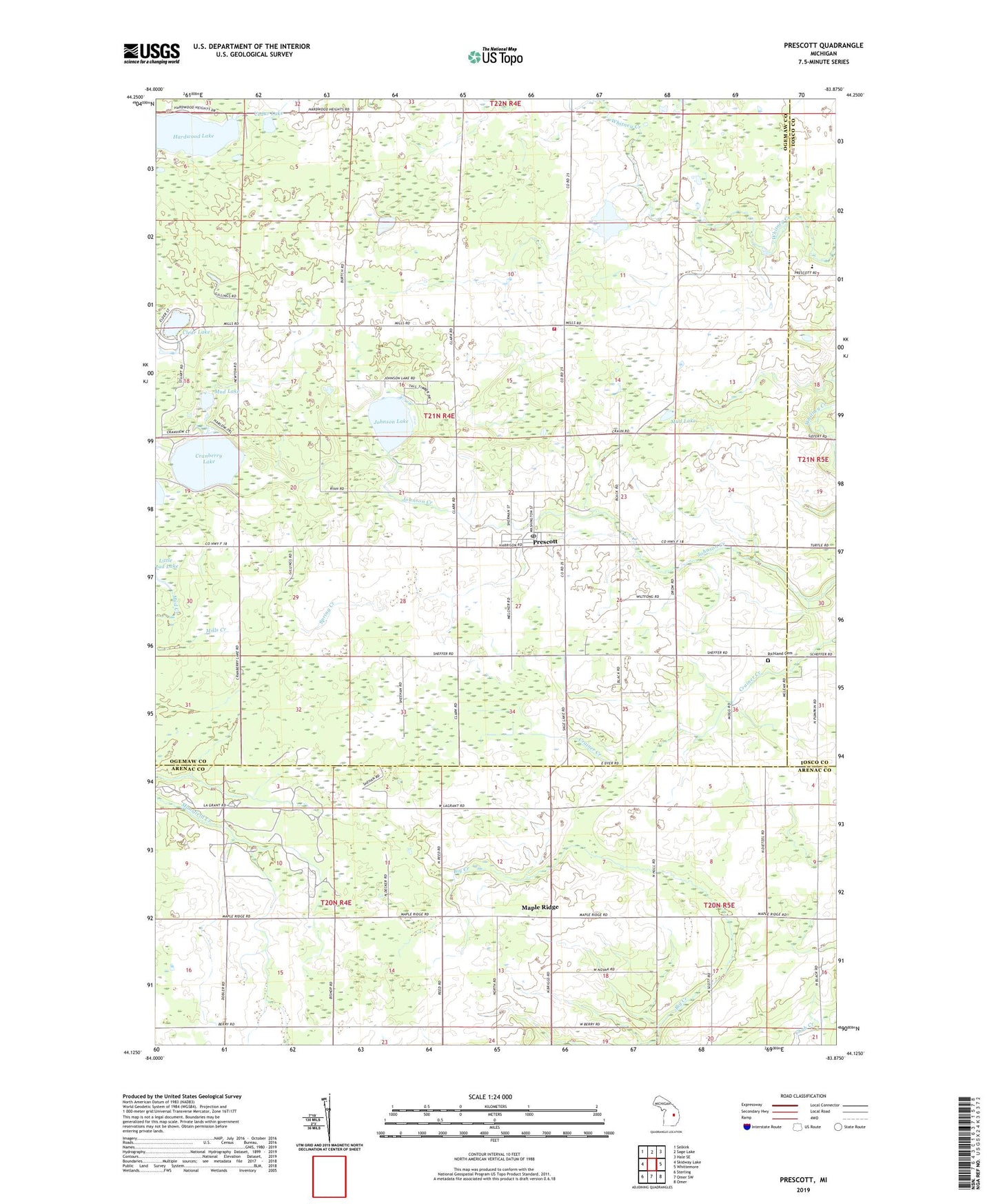
Prescott Michigan US Topo Map
Couldn't load pickup availability
2023 topographic map quadrangle Prescott in the state of Michigan. Scale: 1:24000. Based on the newly updated USGS 7.5' US Topo map series, this map is in the following counties: Ogemaw, Arenac, Iosco. The map contains contour data, water features, and other items you are used to seeing on USGS maps, but also has updated roads and other features. This is the next generation of topographic maps. Printed on high-quality waterproof paper with UV fade-resistant inks.
Quads adjacent to this one:
West: Skidway Lake
Northwest: Selkirk
North: Sage Lake
Northeast: Hale SE
East: Whittemore
Southeast: Omer
South: Omer SW
Southwest: Sterling
This map covers the same area as the classic USGS quad with code o44083b8.
Contains the following named places: Cedar Lake, Church of the Holy Fire, Clayton Oil and Gas Field, Clear Lake, County Line Wesleyan Church, Cranberry Lake, First Presbyterian Church, Hardwood Lake, Johnson Lake, Judson Baptist Church, Maple Ridge, Maple Ridge Post Office, Mud Lake, Ogemaw East Library, Prescott, Prescott Clinic, Prescott Post Office, Prescott Station, Richland Cemetery, Richland Logan Fire Department, Township of Richland, Village of Prescott, Whittemore-Prescott High School, Whittemore-Prescott Junior High School, ZIP Code: 48756