MyTopo
Moddersville Michigan US Topo Map
Couldn't load pickup availability
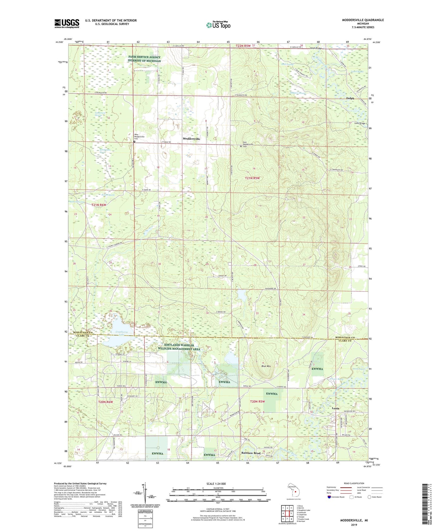
2023 topographic map quadrangle Moddersville in the state of Michigan. Scale: 1:24000. Based on the newly updated USGS 7.5' US Topo map series, this map is in the following counties: Missaukee, Clare. The map contains contour data, water features, and other items you are used to seeing on USGS maps, but also has updated roads and other features. This is the next generation of topographic maps. Printed on high-quality waterproof paper with UV fade-resistant inks.
Quads adjacent to this one:
West: Falmouth
Northwest: Dinca
North: Merritt
Northeast: Houghton Lake
East: Cooperton
Southeast: Harrison
South: Prestle Creek
Southwest: Temple
This map covers the same area as the classic USGS quad with code o44084b8.
Contains the following named places: Blue Mountain, Community Church, Cranberry Lake, Cranberry Lake Oil and Gas Storage Field, Dolph, Dolph Bridge, Dolph Post Office, East Moddersville Cemetery, Leota, Leota Mall, Leota Post Office, Lone Bridge, Modders Swamp, Moddersville, Moddersville Lookout Tower, Moddersville Post Office, Rainbow Bend, Ralyea Marsh, Reformed Church, Rush Swamp, Sandy Bayou, Spitzbergen Marsh, Township of Holland, Vanderwat Swamp, Warner Bayou, West Moddersville Cemetery, ZIP Code: 49632