MyTopo
Hessel Michigan US Topo Map
Couldn't load pickup availability
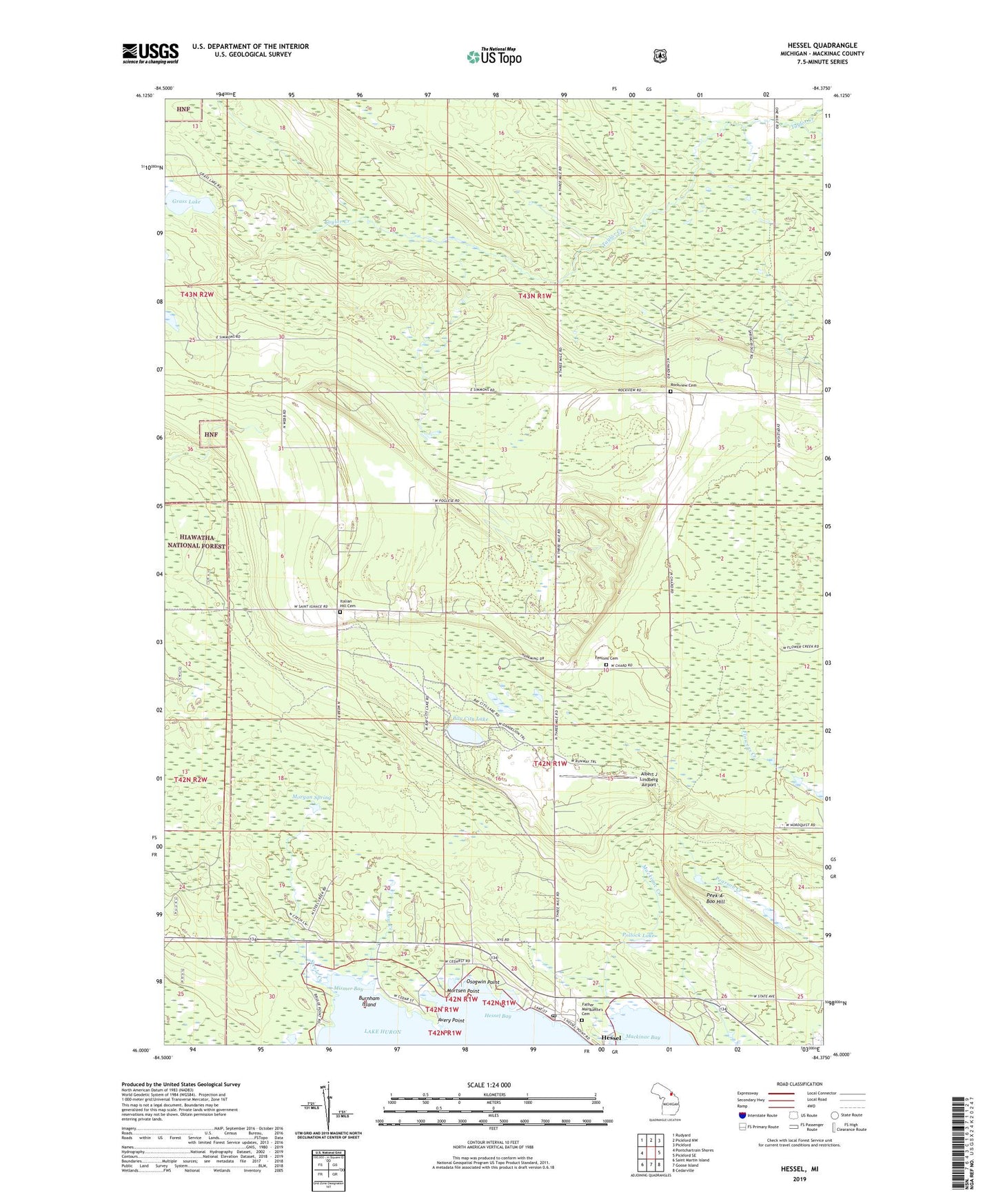
2019 topographic map quadrangle Hessel in the state of Michigan. Scale: 1:24000. Based on the newly updated USGS 7.5' US Topo map series, this map is in the following counties: Mackinac. The map contains contour data, water features, and other items you are used to seeing on USGS maps, but also has updated roads and other features. This is the next generation of topographic maps. Printed on high-quality waterproof paper with UV fade-resistant inks.
Quads adjacent to this one:
West: Pontchartrain Shores
Northwest: Rudyard
North: Pickford NW
Northeast: Pickford
East: Pickford SE
Southeast: Cedarville
South: Goose Island
Southwest: Saint Martin Island
Contains the following named places: Albert J Lindberg Airport, Avery Point, Bay City Lake, Bay City Lake Campground, Burnham Island, Father Marquette's Cemetery, Fenlons Cemetery, Grass Lake, Hessel, Hessel Bay, Hessel Post Office, Hessel Presbyterian Church, Hessel Ridge Golf Course, Italian Hill Cemetery, Law Creek, Les Cheneaux Golf Course, Lighthouse Baptist Church, Mackinac Creek, Maple Forest Campground, Mill Pond, Mismer Bay, Morgan Spring, Mortsen Point, North Hills Baptist Church, Osogwin Point, Our Lady of the Snows Parish, Peek-A-Boo Hill, Pollock Lake, Rockview Cemetery, Rockview Lookout Tower, Steele Creek, V F W Park