MyTopo
Rudyard Michigan US Topo Map
Couldn't load pickup availability
Also explore the Rudyard Forest Service Topo of this same quad for updated USFS data
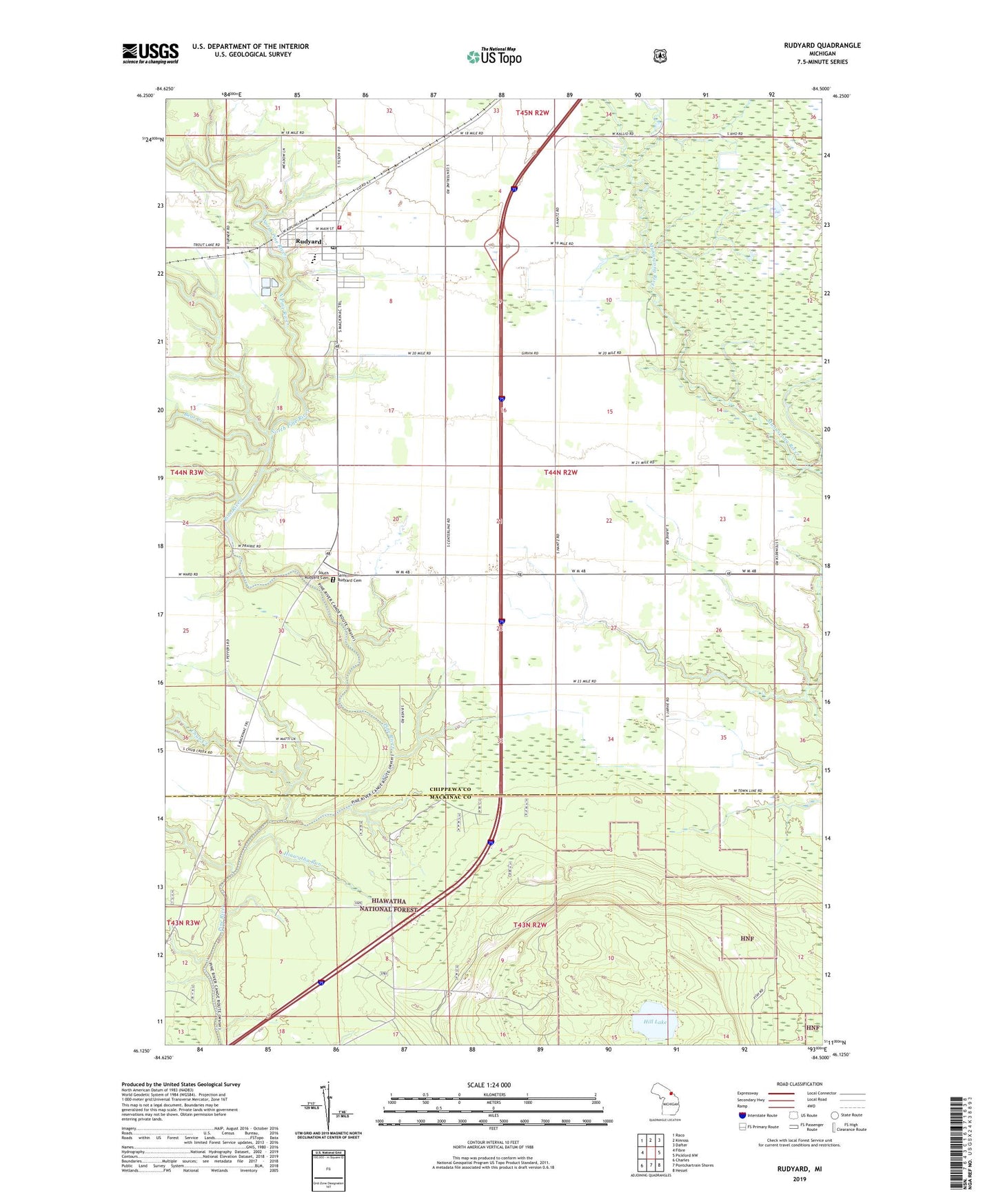
2023 topographic map quadrangle Rudyard in the state of Michigan. Scale: 1:24000. Based on the newly updated USGS 7.5' US Topo map series, this map is in the following counties: Chippewa, Mackinac. The map contains contour data, water features, and other items you are used to seeing on USGS maps, but also has updated roads and other features. This is the next generation of topographic maps. Printed on high-quality waterproof paper with UV fade-resistant inks.
Quads adjacent to this one:
West: Fibre
Northwest: Raco
North: Kinross
Northeast: Dafter
East: Pickford NW
Southeast: Hessel
South: Pontchartrain Shores
Southwest: Charles
This map covers the same area as the classic USGS quad with code o46084b5.
Contains the following named places: Apostolic Church, Bear Creek, Christian Reform Church, Chub Creek, Hiawatha Run, Hill Lake, North Pine River, Presbyterian Church, Rudyard, Rudyard Bible Church, Rudyard High School, Rudyard Post Office, Rudyard Public Library, Rudyard Station, Rudyard Township Park, Rudyard Township Volunteer Fire Department, Saint James Lutheran Church, Saint Joseph Roman Catholic Church, Saint Rudyard Cemetery, South Rudyard Cemetery, Township of Rudyard, Turner Howson Elementary School