
MyTopo
Hiawatha Michigan US Topo Map
Couldn't load pickup availability
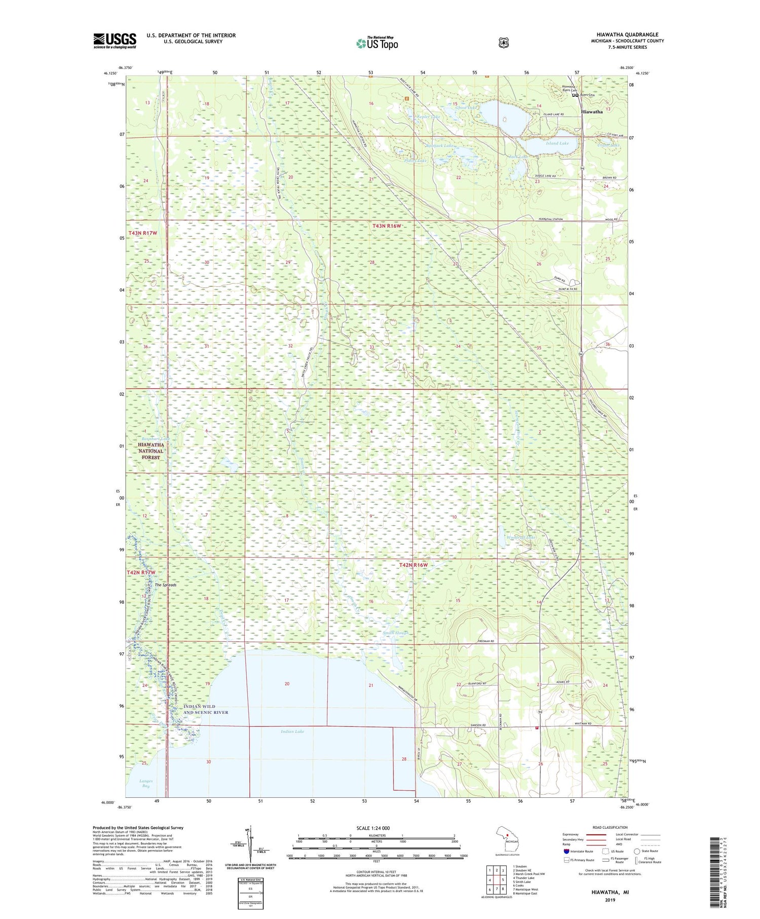
2019 topographic map quadrangle Hiawatha in the state of Michigan. Scale: 1:24000. Based on the newly updated USGS 7.5' US Topo map series, this map is in the following counties: Schoolcraft. The map contains contour data, water features, and other items you are used to seeing on USGS maps, but also has updated roads and other features. This is the next generation of topographic maps. Printed on high-quality waterproof paper with UV fade-resistant inks.
Quads adjacent to this one:
West: Thunder Lake
Northwest: Steuben
North: Steuben NE
Northeast: Marsh Creek Pool NW
East: Smith Lake
Southeast: Manistique East
South: Manistique West
Southwest: Cooks
Contains the following named places: Barnhart Lake, Bootjack Lake, Byers Cemetery, Crane Lake, Dead Creek, Dodge Lake, Ghost Lake, Gray Duck Creek, Hiawatha, Hiawatha / Byers Cemetery, Hiawatha Post Office, Hiawatha Township Volunteer Fire Department, Indian Lake Golf Course, Indian River, Iron Creek, Island Lake, Jack Lake, Kepler Lake, Langes Bay, Palms Book State Park, Plains Lake, Smith Creek, Smith Slough, The Spreads, Woodruff Lake, ZIP Code: 49854


