MyTopo
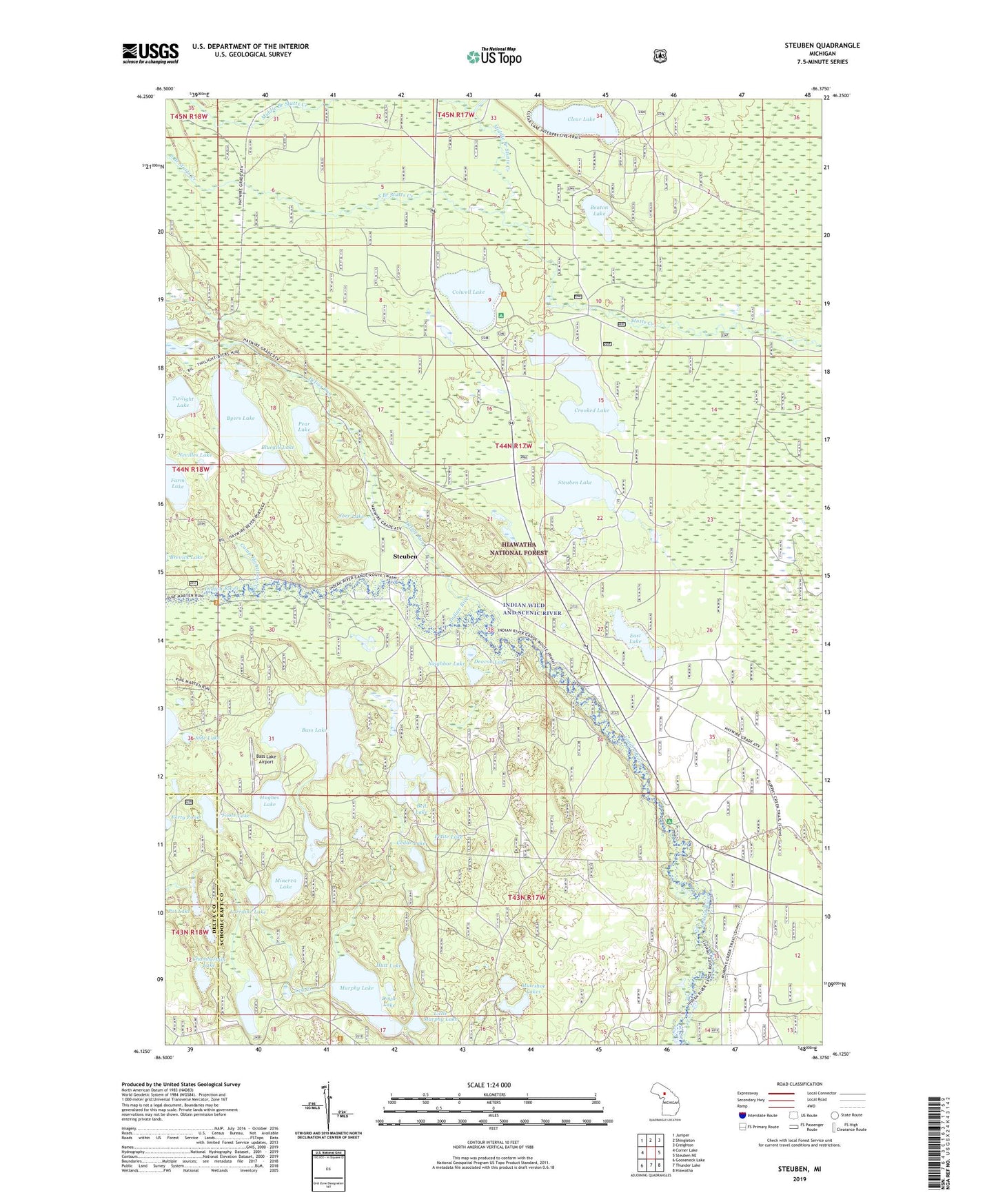
Steuben Michigan US Topo Map
Couldn't load pickup availability
Also explore the Steuben Forest Service Topo of this same quad for updated USFS data
2023 topographic map quadrangle Steuben in the state of Michigan. Scale: 1:24000. Based on the newly updated USGS 7.5' US Topo map series, this map is in the following counties: Schoolcraft, Delta. The map contains contour data, water features, and other items you are used to seeing on USGS maps, but also has updated roads and other features. This is the next generation of topographic maps. Printed on high-quality waterproof paper with UV fade-resistant inks.
Quads adjacent to this one:
West: Corner Lake
Northwest: Juniper
North: Shingleton
Northeast: Creighton
East: Steuben NE
Southeast: Hiawatha
South: Thunder Lake
Southwest: Gooseneck Lake
This map covers the same area as the classic USGS quad with code o46086b4.
Contains the following named places: Bass Lake, Bass Lake Airport, Beaton Lake, Bell Lake, Bluegill Lake, Byers Lake, Camp Eightthree Creek, Cedar Lake, Chamberlain Lake, Clear Lake, Clear Lake Organization Camp, Colwell Lake, Colwell Lake Campground, Crooked Lake, Deacon Lake, Delias Run, Doyle Lake, East Lake, Farm Lake, Foote Lake, Forty Pond, Haywire Grade ORV Trail, Hughes Lake, Hutt Lake, Indian River Campground, Indian Wild and Scenic River, Jarr Lake, Leg Creek, Leg Lake, Little Bass Lake, Little Bass Lake Campground, Little Murphy Lake, Lorraine Lake, Middle Branch Stutts Creek, Minerva Lake, Muleshoe Lakes, Murphy Lake, Neighbor Lake, Nevilles Lake, No Name Lake, Pear Lake, Petite Lake, Pot Lake, Side Lake, South Branch Stutts Creek, Steuben, Steuben Lake, Steuben Lookout Tower, Steuben Post Office, Steuben Station, Three Island Lake, Twilight Lake