MyTopo
Houghton Lake Michigan US Topo Map
Couldn't load pickup availability
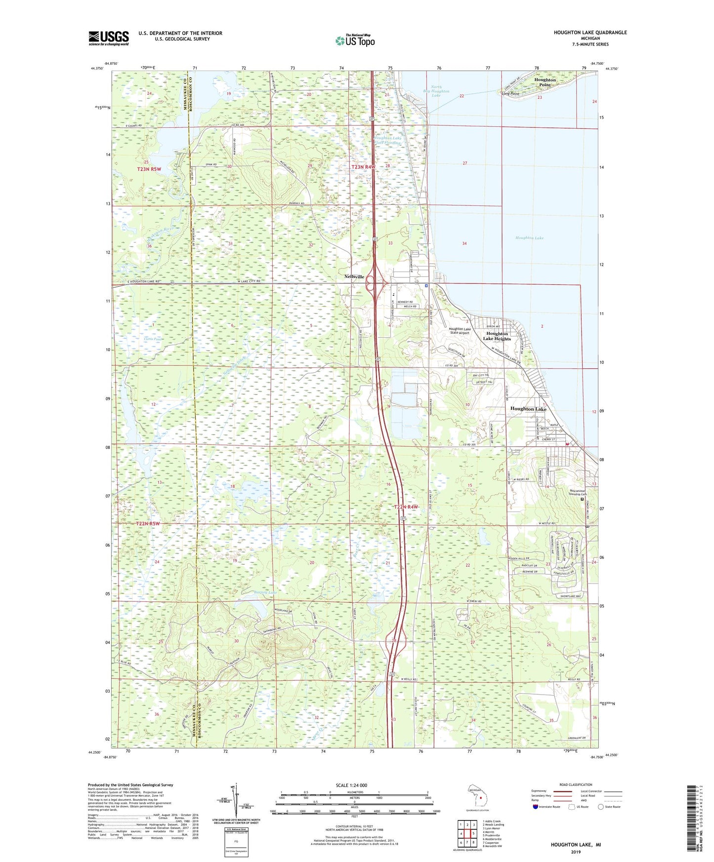
2023 topographic map quadrangle Houghton Lake in the state of Michigan. Scale: 1:24000. Based on the newly updated USGS 7.5' US Topo map series, this map is in the following counties: Roscommon, Missaukee. The map contains contour data, water features, and other items you are used to seeing on USGS maps, but also has updated roads and other features. This is the next generation of topographic maps. Printed on high-quality waterproof paper with UV fade-resistant inks.
Quads adjacent to this one:
West: Merritt
Northwest: Addis Creek
North: Meads Landing
Northeast: Lyon Manor
East: Prudenville
Southeast: Meredith NW
South: Cooperton
Southwest: Moddersville
This map covers the same area as the classic USGS quad with code o44084c7.
Contains the following named places: Anderson School, Barney Lake, Church on the Lakes Free Methodist Church, Curtis Pond, Dead Stream Flooding, Faith Community Church, Heights Marina, Houghton Lake, Houghton Lake Ambulance Authority, Houghton Lake Baptist Church, Houghton Lake Church of Christ, Houghton Lake Community Church, Houghton Lake Flats Flooding, Houghton Lake Heights, Houghton Lake Heights Post Office, Houghton Lake Lookout Tower, Houghton Lake Park, Houghton Lake Post Office, Houghton Lake State Airport, Houghton Lake Wesleyan Church, Houghton Lake Wildlife Research Area, Houghton Point, Houghton Point Post Office, King Nursing Center, Lake Township Hall, Long Point, Loxley, Loxley Post Office, Michigan State Police District 7 Houghton Lake Post 75, MidMichigan Health Park, Nellsville, Nellsville Ditch, Nellsville Post Office, Poplars Resort and Campground, Quest Golf Club, Reedsburg Dam, Reedsburg Dam State Forest Campground, Roscommon Township Cemetery, Roscommon Township Fire Department, Roscommon Township Hall, United Methodist Church, Wooded Acres Family Campground, ZIP Codes: 48629, 48630