MyTopo
Howard City Michigan US Topo Map
Couldn't load pickup availability
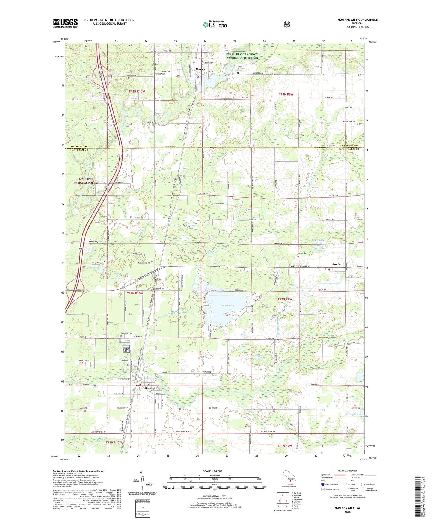
2019 topographic map quadrangle Howard City in the state of Michigan. Scale: 1:24000. Based on the newly updated USGS 7.5' US Topo map series, this map is in the following counties: Montcalm, Mecosta. The map contains contour data, water features, and other items you are used to seeing on USGS maps, but also has updated roads and other features. This is the next generation of topographic maps. Printed on high-quality waterproof paper with UV fade-resistant inks.
Quads adjacent to this one:
West: Tift Corner
Northwest: Big Bend
North: Stanwood
Northeast: Altona
East: Lakeview
Southeast: Trufant
South: Coral
Southwest: Sand Lake
Contains the following named places: Aetna Cemetery, Amble, Amble Cemetery, Amble Post Office, Amble Station, Amble Volunteer Fire Department, Anderson Airport, Bethel Lutheran Church, Big Creek, Body of Christ Family Church, Boyd Cemetery, Burley Lake, Christ the King Church, Conger Post Office, Conger Station, Crane Lake, Deerfield Church, Edgerton Upper Elementary School, Ensley Park, First Baptist Church, Gaffield School, Grace Community Church, Henkel Lake, Herbert J Peck Park, Howard City, Howard City Fire Department, Howard City Police Department, Howard City Post Office, Howard City Station, Indian Creek Drain, Indian Lake, Krampe Lake, MacNaughton Elementary School, Marne United Methodist Church, Mecosta Pines RV Park, Minnie Farmer Park, Morley, Morley Area Fire Department, Morley Elementary School, Morley Police Department, Morley Pond, Morley Post Office, Morley Rest Area, Morley Station, North Greenville Station, Reynold Post Office, Reynolds Cemetery, Reynolds Township Library, Saint Apollonia Cemetery, Tamarack Estates Mobile Home Park, Township of Winfield, Village of Howard City, Village of Morley, Weatherby Drain, ZIP Code: 49329