MyTopo
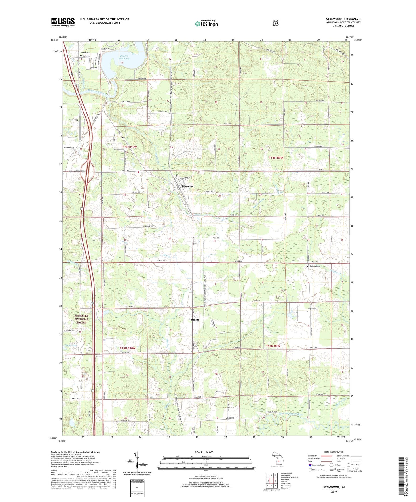
Stanwood Michigan US Topo Map
Couldn't load pickup availability
Also explore the Stanwood Forest Service Topo of this same quad for updated USFS data
2023 topographic map quadrangle Stanwood in the state of Michigan. Scale: 1:24000. Based on the newly updated USGS 7.5' US Topo map series, this map is in the following counties: Mecosta. The map contains contour data, water features, and other items you are used to seeing on USGS maps, but also has updated roads and other features. This is the next generation of topographic maps. Printed on high-quality waterproof paper with UV fade-resistant inks.
Quads adjacent to this one:
West: Big Bend
Northwest: Woodville NE
North: Big Rapids
Northeast: Chippewa Lake South
East: Altona
Southeast: Lakeview
South: Howard City
Southwest: Tift Corner
This map covers the same area as the classic USGS quad with code o43085e4.
Contains the following named places: Borland, Borland Post Office, Borland Station, Cain Field, Cold Spring Creek, Doyle Lake, Green School, Higbee Cemetery, Higbee Corner, Holt Cemetery, Ladner Cemetery, Ladner Creek, Macks Creek, Mecosta - Austin Fire Department, Mecosta Lookout Tower, Morley Stanwood High School, Morley Stanwood Middle School, Northland United Methodist Church, Quigley Cemetery, Quigley Creek, Rogers Dam, Rogers Dam Pond, Rogers Heights Christian Church, Saint Thomas Lutheran Church, Stanwood, Stanwood Elementary School, Stanwood Free Methodist Church, Stanwood Post Office, Stanwood Station, Township of Austin, Township of Deerfield, Village of Stanwood, Walton Erickson Public Library, WWTG-AM (Stanwood), ZIP Codes: 49336, 49346