MyTopo
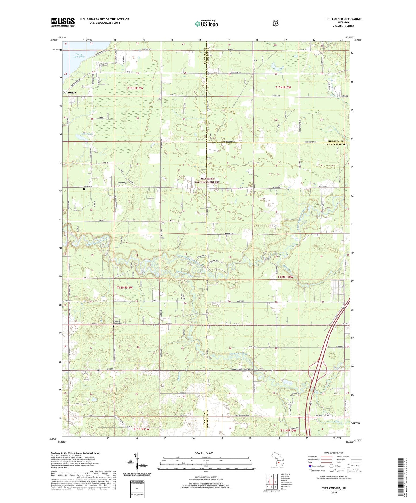
Tift Corner Michigan US Topo Map
Couldn't load pickup availability
Also explore the Tift Corner Forest Service Topo of this same quad for updated USFS data
2023 topographic map quadrangle Tift Corner in the state of Michigan. Scale: 1:24000. Based on the newly updated USGS 7.5' US Topo map series, this map is in the following counties: Newaygo, Montcalm, Mecosta. The map contains contour data, water features, and other items you are used to seeing on USGS maps, but also has updated roads and other features. This is the next generation of topographic maps. Printed on high-quality waterproof paper with UV fade-resistant inks.
Quads adjacent to this one:
West: Croton
Northwest: Big Prairie
North: Big Bend
Northeast: Stanwood
East: Howard City
Southeast: Coral
South: Sand Lake
Southwest: Sand Lake SW
This map covers the same area as the classic USGS quad with code o43085d5.
Contains the following named places: Christian Plains Cemetery, Culp Cemetery, Four Seasons Trailer Park, Handy Creek, Howe Airport, Luther Chapel, Oxbow, Pine Grove Chapel, Pine Grove Christian School, Rice Creek, Ryan Creek, Stearns Prairie Cemetery, Tamarack Creek, Tift Corner, Township of Croton, Township of Reynolds, Tucker Lake, Wayside Church