MyTopo
Big Bend Michigan US Topo Map
Couldn't load pickup availability
Also explore the Big Bend Forest Service Topo of this same quad for updated USFS data
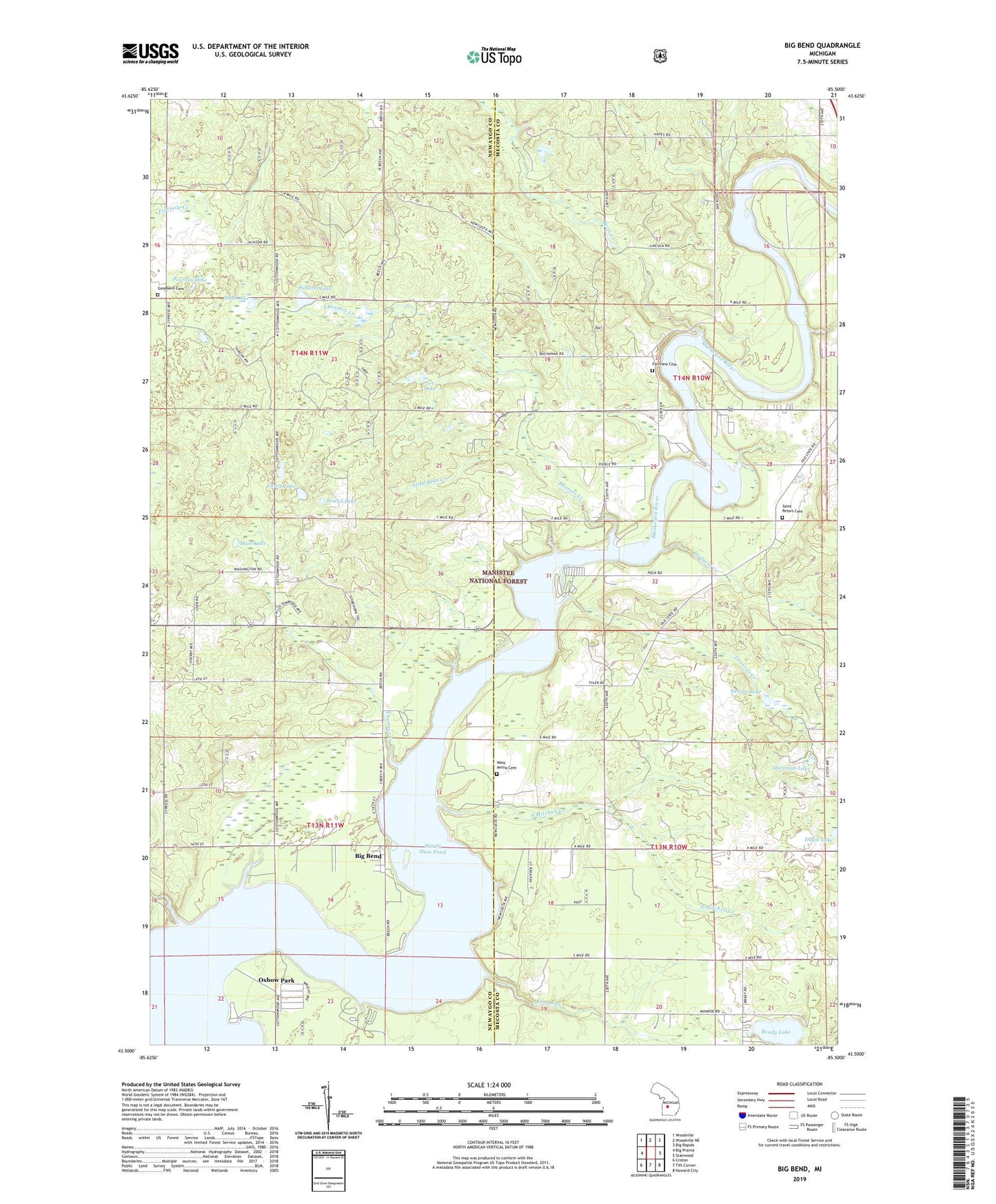
2023 topographic map quadrangle Big Bend in the state of Michigan. Scale: 1:24000. Based on the newly updated USGS 7.5' US Topo map series, this map is in the following counties: Mecosta, Newaygo. The map contains contour data, water features, and other items you are used to seeing on USGS maps, but also has updated roads and other features. This is the next generation of topographic maps. Printed on high-quality waterproof paper with UV fade-resistant inks.
Quads adjacent to this one:
West: Big Prairie
Northwest: Woodville
North: Woodville NE
Northeast: Big Rapids
East: Stanwood
Southeast: Howard City
South: Tift Corner
Southwest: Croton
This map covers the same area as the classic USGS quad with code o43085e5.
Contains the following named places: Bennett Creek, Betts Creek, Big Bend, Big Bend Township Park, Big Prairie Township Park, Brady Lake, Breezy Knoll Park, Brower Park, Carey Lake, Davis Park Bridge, Fairview Cemetery, Goodwell Township Cemetery, Hardy Dam Pond, Hartman Lake, Hodgers Creek, Laverne Creek, Lee Lake, Linn Creek, Little Bear Creek, Mast Lake, Mud Lake, Nelson Lake, Newaygo State Park, Newaygo State Park Rustic Campground, Oxbow Park, Pearson Lake, Pickerel Lake, Rosy Run, Round Lake, Saint Peters Cemetery, South Mitchell Creek, Thumser Creek, Township of Aetna, Township of Big Prairie, Township of Goodwell, Township of Mecosta, West Aetna Cemetery