MyTopo
Altona Michigan US Topo Map
Couldn't load pickup availability
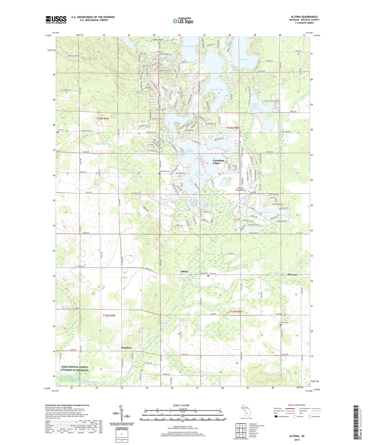
2023 topographic map quadrangle Altona in the state of Michigan. Scale: 1:24000. Based on the newly updated USGS 7.5' US Topo map series, this map is in the following counties: Mecosta. The map contains contour data, water features, and other items you are used to seeing on USGS maps, but also has updated roads and other features. This is the next generation of topographic maps. Printed on high-quality waterproof paper with UV fade-resistant inks.
Quads adjacent to this one:
West: Stanwood
Northwest: Big Rapids
North: Chippewa Lake South
Northeast: Mecosta NW
East: Mecosta
Southeast: Six Lakes
South: Lakeview
Southwest: Howard City
This map covers the same area as the classic USGS quad with code o43085e3.
Contains the following named places: Altona, Altona Cemetery, Altona Post Office, Altona Riverside Park, Austin Church, Beaver Lake, Blue Lake, Brockway Christian Academy, Brockway Church, Burden Lake, Camper Lake, Canadian Lakes, Canadian Lakes Airport, Canadian Lakes Census Designated Place, Canadian Lakes Country Club, Capen Airport, Cedar Creek, Dukes Lake, East Branch Little Muskegon River, East Canadian Lake, Eastside Family Medical Clinic, Gilbert Creek, Hinton Cemetery, Indian Cemetery, Lake Laura, Lake Mecosta, Lake of the Clouds, Lost Canyon Lake, Lost Lake, Morton Township Fire and Rescue Department Station 1, Negro Settlers Historical Marker, Olin Cemetery, Ranger Lake, Round Lake, Rustford, Rustford Dam, Rustford Post Office, Saint Ives Golf Club, Satterlee's Mills Post Office, School Section Lake, School Section Lake Park, Shinglebolt Creek, Stanwood Cemetery, Sylvester, Sylvester Community Church, Sylvester Creek, Sylvester Post Office, Township of Hinton, Township of Morton, Tullymore Golf Course, West Branch Little Muskegon River, West Canadian Lake