MyTopo
Hubbard Lake Michigan US Topo Map
Couldn't load pickup availability
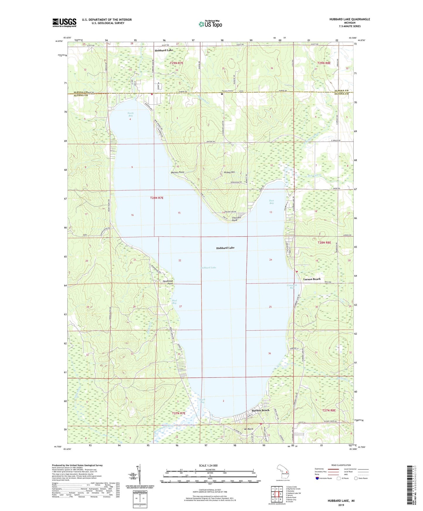
2019 topographic map quadrangle Hubbard Lake in the state of Michigan. Scale: 1:24000. Based on the newly updated USGS 7.5' US Topo map series, this map is in the following counties: Alcona, Alpena. The map contains contour data, water features, and other items you are used to seeing on USGS maps, but also has updated roads and other features. This is the next generation of topographic maps. Printed on high-quality waterproof paper with UV fade-resistant inks.
Quads adjacent to this one:
West: Hubbard Lake SW
Northwest: Evans Creek
North: Big Ravine Creek
Northeast: Ossineke
East: Spruce
Southeast: Lincoln
South: Barton City
Southwest: Bucks Pond
Contains the following named places: Alcona Township Fire Department Station 2, Alcona Township Library, Backus Beach, Caledonia School, Churchill Point, Comstock Bay, Doctors Point, East Bay, Flowers Grave, Hardwood Point, Hickey Hill, Holcomb Creek, Hubbard Lake, Hubbard Lake Census Designated Place, Hubbard Lake Fire Department, Hubbard Lake Post Office, Larson Beach, Mount Maria, Mount Maria Ski Area, Mud Bay, North Bay, North Branch Holcomb Creek, Simmons Creek, South Bay, South Shore Hubbard Lake Fire Department, Stevens Creek, Sucker Creek, Township of Caledonia, WATZ-FM (Alpena), West Branch River, White Pine National Golf Course