MyTopo
Otisville Michigan US Topo Map
Couldn't load pickup availability
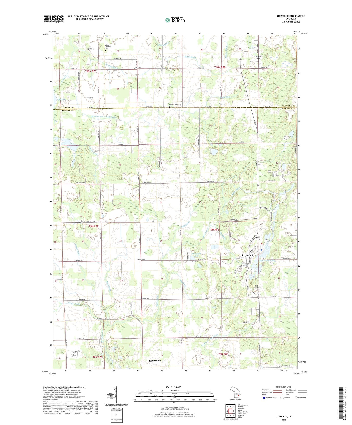
2023 topographic map quadrangle Otisville in the state of Michigan. Scale: 1:24000. Based on the newly updated USGS 7.5' US Topo map series, this map is in the following counties: Genesee, Tuscola. The map contains contour data, water features, and other items you are used to seeing on USGS maps, but also has updated roads and other features. This is the next generation of topographic maps. Printed on high-quality waterproof paper with UV fade-resistant inks.
Quads adjacent to this one:
West: Clio
Northwest: Frankenmuth
North: Vassar
Northeast: Juniata
East: Columbiaville
Southeast: Elba
South: Davison
Southwest: Flint North
This map covers the same area as the classic USGS quad with code o43083b5.
Contains the following named places: Adams Drain, Arbela Township Cemetery, Averill Drain, Barden Branch, Buell Drain, Buell Lake, Buell Lake County Park, Burns Drain, Burroughs Lake, Clew Post Office, Coe Drain, Community Bible Church, Covenant Hills Campground, Dock Lake, Drudge Drain, East Arbela Church, East Thetford Post Office, Emmanuel Baptist Church, Forest Township Fire Department, Frost Drain, Grass Roots Airport, Hopkins Cemetery, Jackson Branch, McCormick Lake, Methodist United Church, Misner Drain, Mount Nebo Church, Mud Lake, Nunn Drain, Otisville, Otisville Assembly of God Church, Otisville Church of Christ, Otisville Elementary School, Otisville Police Department, Otisville Post Office, Otisville Station, Otisville United Methodist Church, Parker Scothan Drain, Pettit Park, Picnic Lake, Rogersville Station, Saint Francis Xavier Church, Saint Timothy Lutheran Church, Sand Lake, Smith Hill Cemetery, Smith Hill Cemetery Historical Marker, Southwest School, Thetford and Arbela Drain, Torrey Drain, Township of Forest, Village of Otisville, West Forest Church, Wilbur Drain, ZIP Code: 48463