MyTopo
K P Lake Michigan US Topo Map
Couldn't load pickup availability
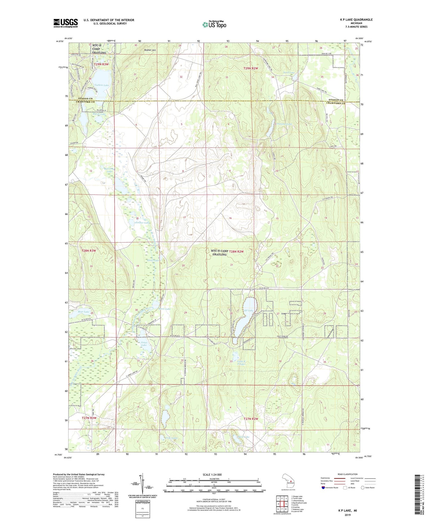
2019 topographic map quadrangle K P Lake in the state of Michigan. Scale: 1:24000. Based on the newly updated USGS 7.5' US Topo map series, this map is in the following counties: Crawford, Otsego. The map contains contour data, water features, and other items you are used to seeing on USGS maps, but also has updated roads and other features. This is the next generation of topographic maps. Printed on high-quality waterproof paper with UV fade-resistant inks.
Quads adjacent to this one:
West: Big Bradford Lake
Northwest: Otsego Lake
North: Turtle Lake
Northeast: Johannesburg
East: Lovells
Southeast: Luzerne NW
South: Wakeley Lake
Southwest: Grayling
Contains the following named places: Barnes Lake, Bear Lake, Bull Frog Lake, Clear Lake, Duck Lake, Frog Lakes, Guthrie Lake, Johnson Lake, Jones Lake, Jones Lake State Forest Campground, KP Lake, Little K P Lake, Lonesome Lake, Marsh Lake, Redner Hill, River Lake, Sand Lake, Section One Lake, Timber Lake