MyTopo
Wakeley Lake Michigan US Topo Map
Couldn't load pickup availability
Also explore the Wakeley Lake Forest Service Topo of this same quad for updated USFS data
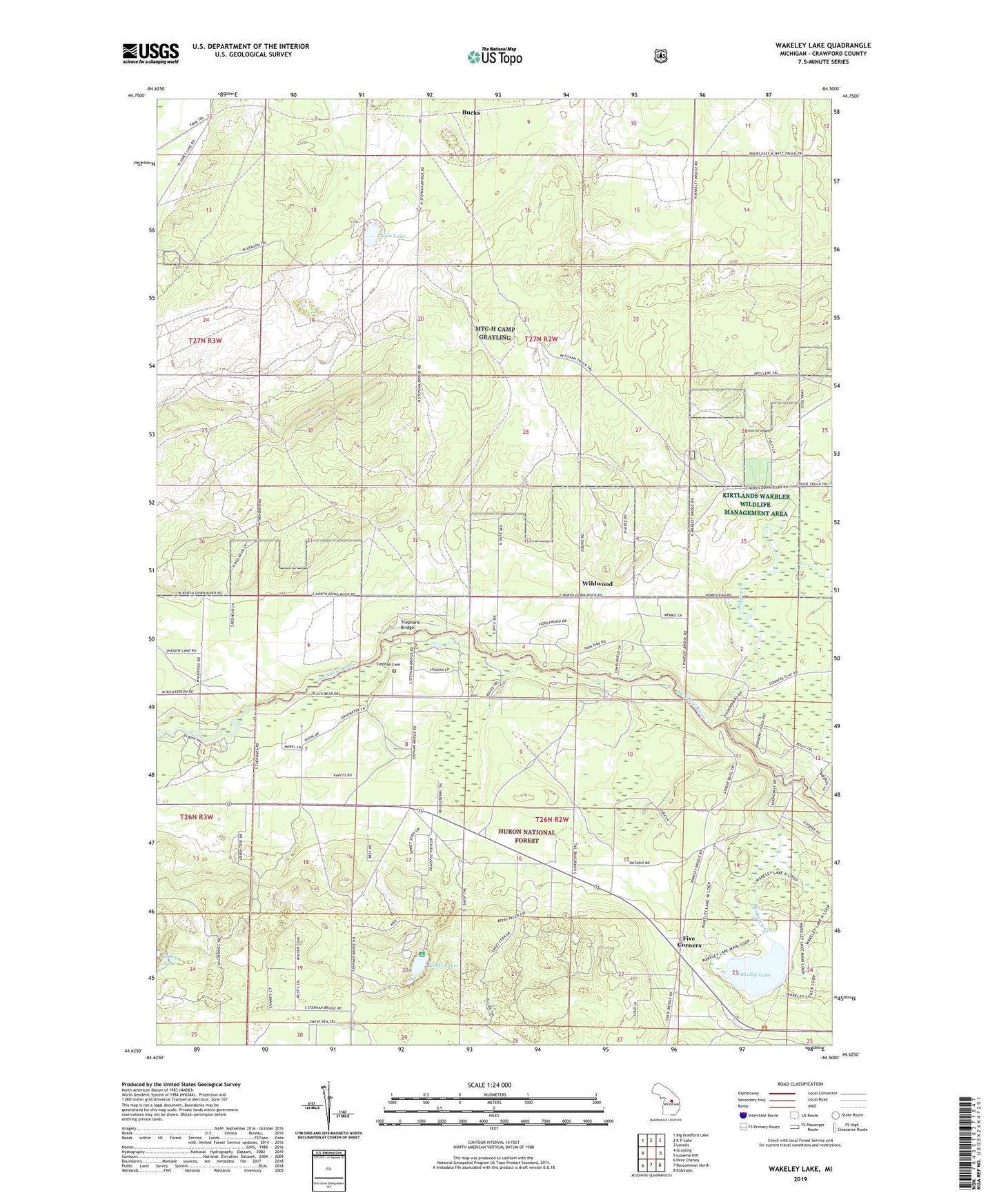
2023 topographic map quadrangle Wakeley Lake in the state of Michigan. Scale: 1:24000. Based on the newly updated USGS 7.5' US Topo map series, this map is in the following counties: Crawford. The map contains contour data, water features, and other items you are used to seeing on USGS maps, but also has updated roads and other features. This is the next generation of topographic maps. Printed on high-quality waterproof paper with UV fade-resistant inks.
Quads adjacent to this one:
West: Grayling
Northwest: Big Bradford Lake
North: K P Lake
Northeast: Lovells
East: Luzerne NW
Southeast: Eldorado
South: Roscommon North
Southwest: Pere Cheney
This map covers the same area as the classic USGS quad with code o44084f5.
Contains the following named places: Babbits Resort, Barker Creek, Bucks, Bucks Station, Camp Ginger Quill, Camp Shoppenagon, Camp Wa-Wa-Sum, Crawford County, Down River Fire Tower, Feldhauser School, Five Corners, Kneff Lakes, Kneff Lakes Campground, Kyle Lake, Sigsbee Post Office, Stephan Cemetery, Stephans Bridge, Wakeley Creek, Wakeley Lake, Wildwood, ZIP Code: 49738