MyTopo
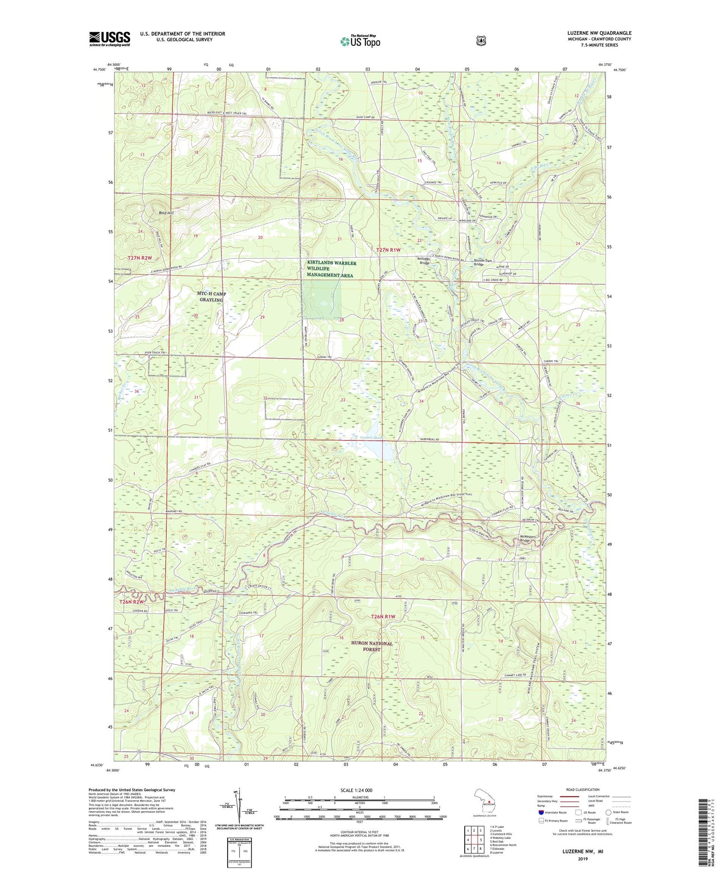
Luzerne NW Michigan US Topo Map
Couldn't load pickup availability
Also explore the Luzerne NW Forest Service Topo of this same quad for updated USFS data
2023 topographic map quadrangle Luzerne NW in the state of Michigan. Scale: 1:24000. Based on the newly updated USGS 7.5' US Topo map series, this map is in the following counties: Crawford. The map contains contour data, water features, and other items you are used to seeing on USGS maps, but also has updated roads and other features. This is the next generation of topographic maps. Printed on high-quality waterproof paper with UV fade-resistant inks.
Quads adjacent to this one:
West: Wakeley Lake
Northwest: K P Lake
North: Lovells
Northeast: Comstock Hills
East: Red Oak
Southeast: Luzerne
South: Eldorado
Southwest: Roscommon North
This map covers the same area as the classic USGS quad with code o44084f4.
Contains the following named places: Bald Hill, Big Creek, Blonde Dam Bridge, Carter Creek, Conners Marsh, Conners Marsh Flooding, East Branch Big Creek, Gammey Creek, Kelleys Airport, Kelloggs Bridge, McMasters Bridge, Middle Branch Big Creek, North Branch Au Sable River, Rainbow Bend Forest Campground, South Branch Au Sable River, West Branch Big Creek, White Pine Campground, White Pine Canoe Camp