MyTopo
Turtle Lake Michigan US Topo Map
Couldn't load pickup availability
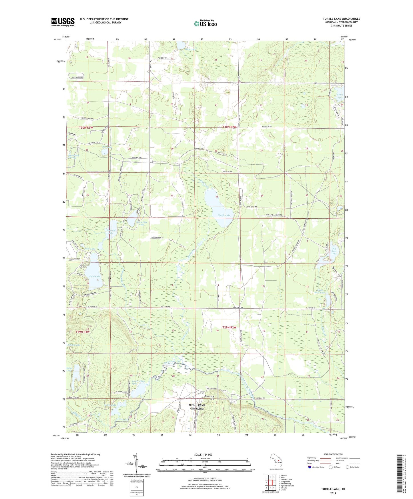
2023 topographic map quadrangle Turtle Lake in the state of Michigan. Scale: 1:24000. Based on the newly updated USGS 7.5' US Topo map series, this map is in the following counties: Otsego. The map contains contour data, water features, and other items you are used to seeing on USGS maps, but also has updated roads and other features. This is the next generation of topographic maps. Printed on high-quality waterproof paper with UV fade-resistant inks.
Quads adjacent to this one:
West: Otsego Lake
Northwest: Gaylord
North: Sparr
Northeast: Saunders Creek
East: Johannesburg
Southeast: Lovells
South: K P Lake
Southwest: Big Bradford Lake
This map covers the same area as the classic USGS quad with code o44084h5.
Contains the following named places: Bell Marie Lake, Big Bass Lake, Bob Lake, Chub Creek, Chub River Ranch, Emerald Lake, Farrar Landing, Finnegan Lake, Grass Lake, Jean Lake, Little Bass Lake, Lower Chub Lake, Lower Chub Landing, Oley Lake, Opal Lake, Range Line Dam, Rosecrans Hill, Town Line Lake, Township of Chester, Triple K Ranch, Turtle Creek, Turtle Lake, Viking Lake, Whites Landing