MyTopo
Kings Corners Michigan US Topo Map
Couldn't load pickup availability
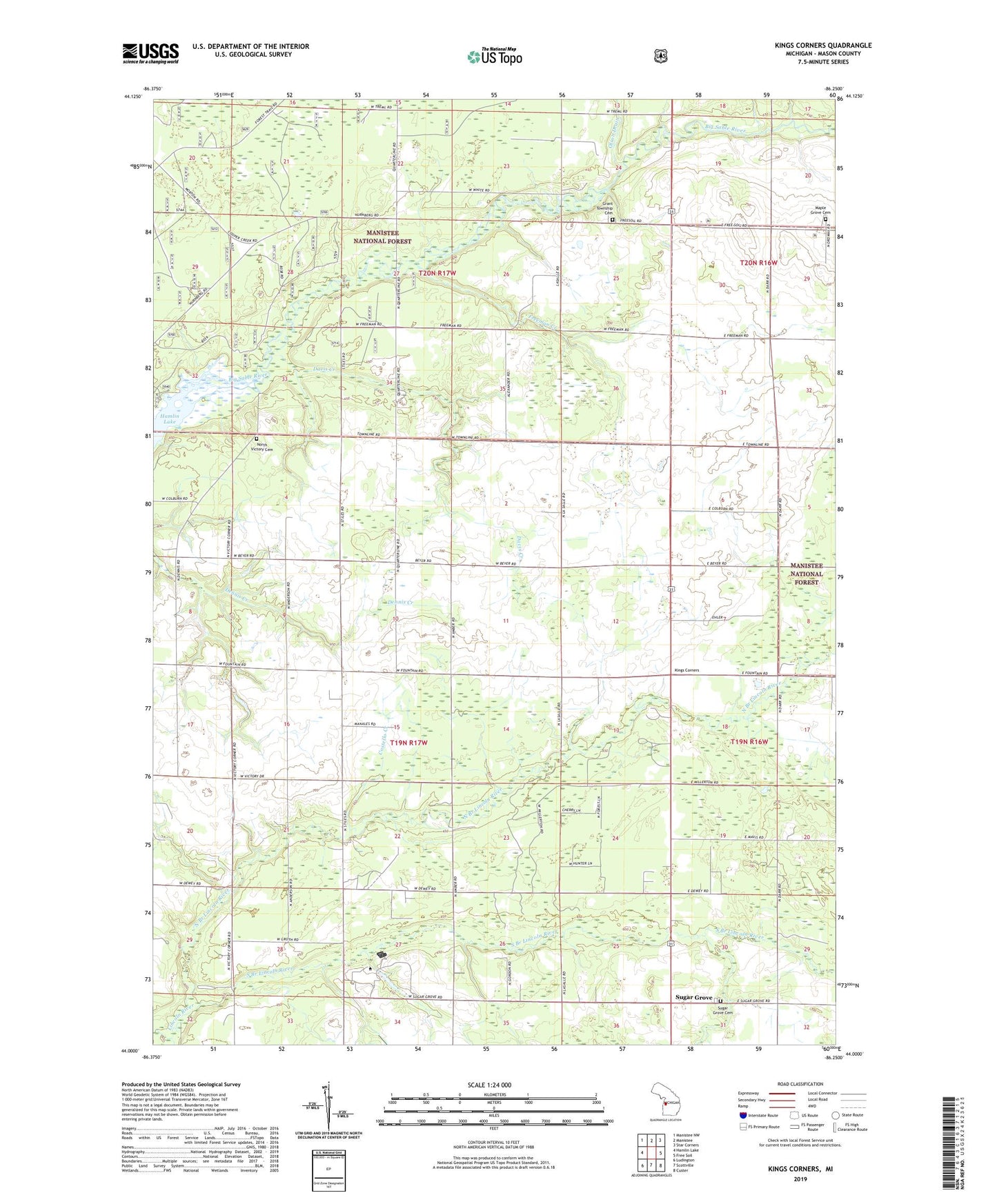
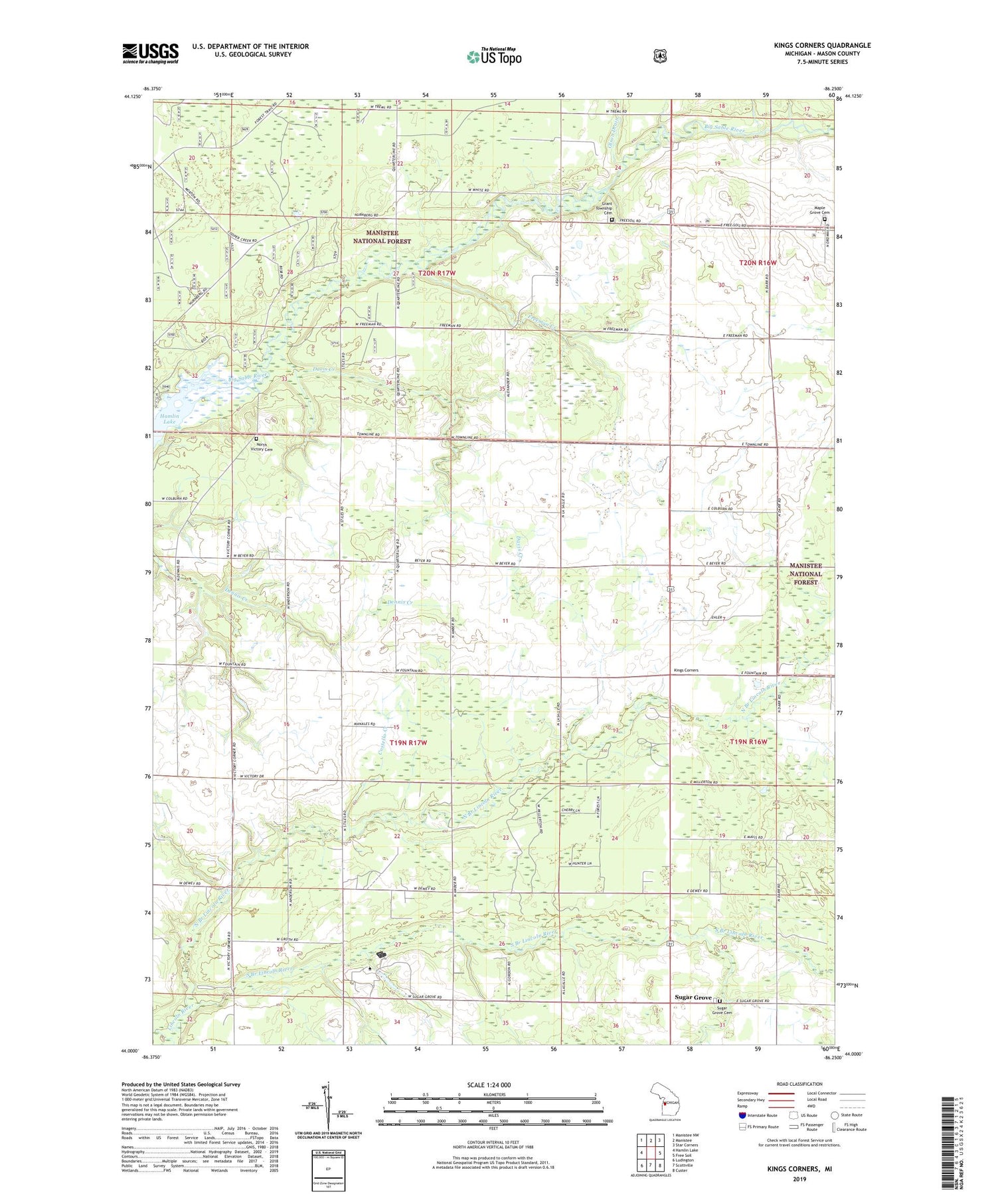
2019 topographic map quadrangle Kings Corners in the state of Michigan. Scale: 1:24000. Based on the newly updated USGS 7.5' US Topo map series, this map is in the following counties: Mason. The map contains contour data, water features, and other items you are used to seeing on USGS maps, but also has updated roads and other features. This is the next generation of topographic maps. Printed on high-quality waterproof paper with UV fade-resistant inks.
Quads adjacent to this one:
West: Hamlin Lake
Northwest: Manistee NW
North: Manistee
Northeast: Star Corners
East: Free Soil
Southeast: Custer
South: Scottville
Southwest: Ludington
Contains the following named places: Costello Creek, Davis Creek, Freeman Creek, Grant Township Cemetery, Kings Corners, Lincoln River School, Maple Grove Cemetery, North Branch Lincoln River, North Victory Cemetery, Olson Drain, Saint Johns Church, South Branch Lincoln River, Sugar Grove, Sugar Grove Cemetery, Sugargrove Post Office, Township of Grant, Township of Victory, Trinity Church, Victory Township School, WCMW-TV (Manistee), West Shore Community College, ZIP Code: 49411