MyTopo
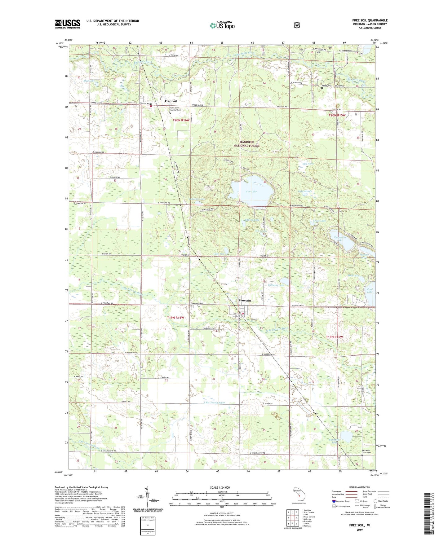
Free Soil Michigan US Topo Map
Couldn't load pickup availability
Also explore the Free Soil Forest Service Topo of this same quad for updated USFS data
2023 topographic map quadrangle Free Soil in the state of Michigan. Scale: 1:24000. Based on the newly updated USGS 7.5' US Topo map series, this map is in the following counties: Mason. The map contains contour data, water features, and other items you are used to seeing on USGS maps, but also has updated roads and other features. This is the next generation of topographic maps. Printed on high-quality waterproof paper with UV fade-resistant inks.
Quads adjacent to this one:
West: Kings Corners
Northwest: Manistee
North: Star Corners
Northeast: Udell
East: Millerton
Southeast: Tallman
South: Custer
Southwest: Scottville
Contains the following named places: Alma Lake, Bachellor Cemetery, Bachelor Evangelical Church, Bachelor Post Office, Batcheller, Batcheller Lake, Batcheller School, Batchelor Station, Camp Sauble State Prison, Chancellor Lake, Edging Lake, Elm Flats School, Ford Lake School, Fountain, Fountain Area Fire Department, Fountain Cemetery, Fountain Post Office, Fountain Station, Fountain United Methodist Church, Free Soil, Free Soil Post Office, Freesoil - Meade Township Fire Department, Freesoil Community School, Freesoil Station, Freesoil United Methodist Church, Frog Marsh, Frog Paradise Drain, Grass Lake, Gun Lake, Howell School, Lake Meade, Lake Two, Meade Cemetery, Mud Lake, Pickerel Lake, Reek School, Ritters Creek, Roderick Lake, Saint John Cantius Catholic Church, Saint John Cantius Cemetery, Sherman Township Hall, Stewart School, Township of Sherman, Village of Fountain, Village of Free Soil, Williams Lake, ZIP Code: 49410