
MyTopo
Lake Stella Michigan US Topo Map
Couldn't load pickup availability
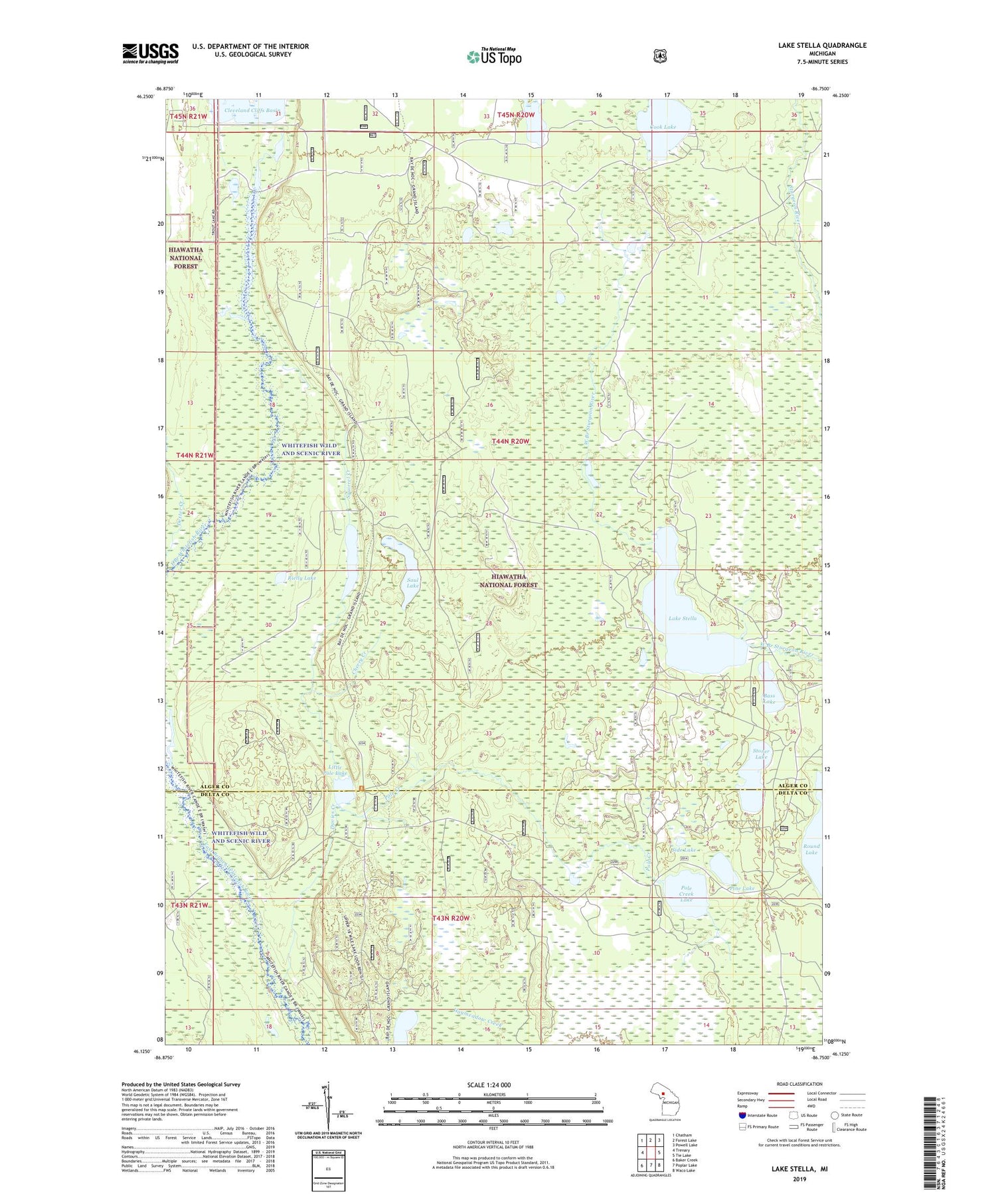
2019 topographic map quadrangle Lake Stella in the state of Michigan. Scale: 1:24000. Based on the newly updated USGS 7.5' US Topo map series, this map is in the following counties: Alger, Delta. The map contains contour data, water features, and other items you are used to seeing on USGS maps, but also has updated roads and other features. This is the next generation of topographic maps. Printed on high-quality waterproof paper with UV fade-resistant inks.
Quads adjacent to this one:
West: Trenary
Northwest: Chatham
North: Forest Lake
Northeast: Powell Lake
East: Tie Lake
Southeast: Waco Lake
South: Poplar Lake
Southwest: Baker Creek
Contains the following named places: Bass Lake, Cherry Creek, Cook Lake, Davies Creek, Davies Lake, Lake Stella, Little Pole Lake, Paquette Lake, Pine Lake, Pole Creek, Pole Creek Lake, Pole Creek Recreation Site, Rielly Lake, Saul Lake, Side Lake, Squirrel Creek, Stoner Lake, Township of Mathias, Trout Lake, Upper Eighteenmile Lake


