MyTopo
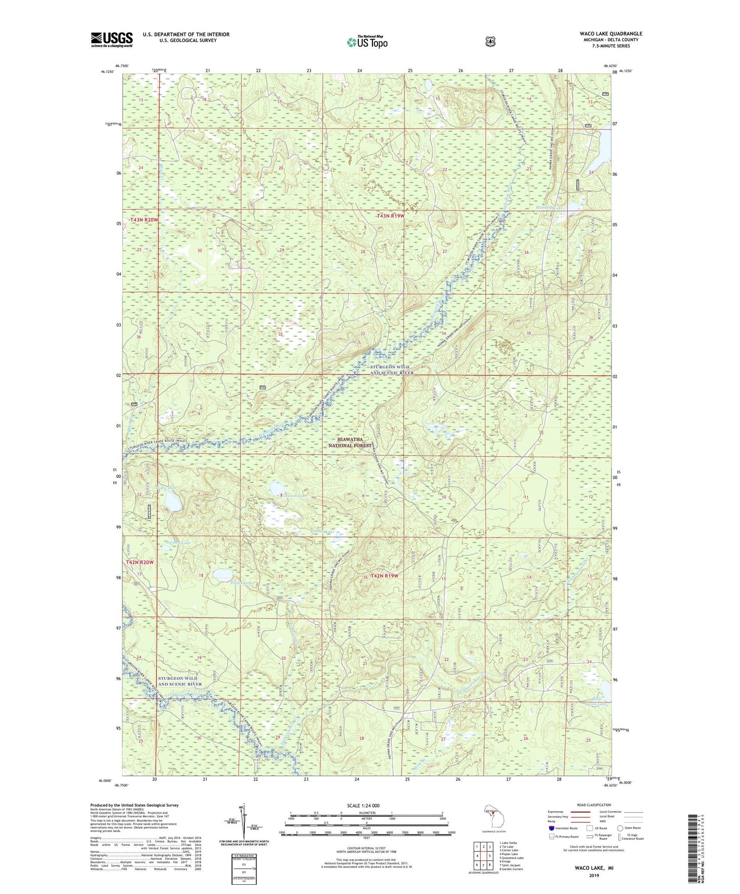
Waco Lake Michigan US Topo Map
Couldn't load pickup availability
Also explore the Waco Lake Forest Service Topo of this same quad for updated USFS data
2023 topographic map quadrangle Waco Lake in the state of Michigan. Scale: 1:24000. Based on the newly updated USGS 7.5' US Topo map series, this map is in the following counties: Delta. The map contains contour data, water features, and other items you are used to seeing on USGS maps, but also has updated roads and other features. This is the next generation of topographic maps. Printed on high-quality waterproof paper with UV fade-resistant inks.
Quads adjacent to this one:
West: Poplar Lake
Northwest: Lake Stella
North: Tie Lake
Northeast: Corner Lake
East: Gooseneck Lake
Southeast: Garden Corners
South: Saint Jacques
Southwest: Ensign
This map covers the same area as the classic USGS quad with code o46086a6.
Contains the following named places: Billy Good Lake, Black Creek, Camp Twentysix, Dana Lake, Eighteenmile Creek, Gleason Lake, Hiawatha National Forest, Johnson Creek, Kenobo Lake, Lakes Camp, Mink Creek, Narbon Lake, Palos Camp, Petoskey Hunting Club, Plumbob Lake, Polack Lake, Waco Lake, Waco Lookout Tower