MyTopo
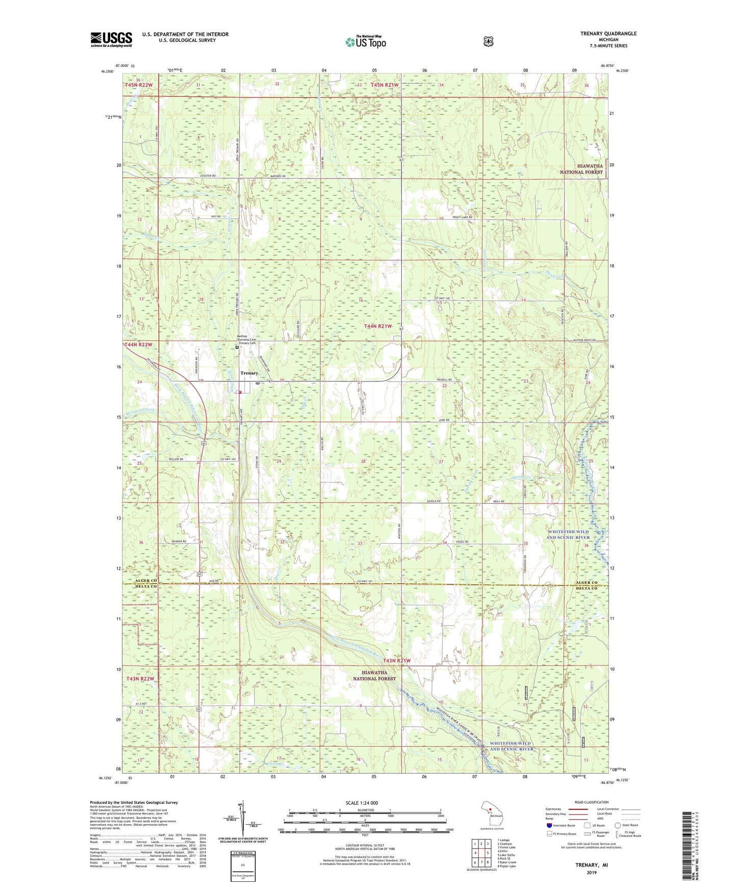
Trenary Michigan US Topo Map
Couldn't load pickup availability
Also explore the Trenary Forest Service Topo of this same quad for updated USFS data
2023 topographic map quadrangle Trenary in the state of Michigan. Scale: 1:24000. Based on the newly updated USGS 7.5' US Topo map series, this map is in the following counties: Alger, Delta. The map contains contour data, water features, and other items you are used to seeing on USGS maps, but also has updated roads and other features. This is the next generation of topographic maps. Printed on high-quality waterproof paper with UV fade-resistant inks.
Quads adjacent to this one:
West: Diffin
Northwest: Ladoga
North: Chatham
Northeast: Forest Lake
East: Lake Stella
Southeast: Poplar Lake
South: Baker Creek
Southwest: Rock SE
This map covers the same area as the classic USGS quad with code o46086b8.
Contains the following named places: Dexter Creek, Dry Creek, First Church, Hayes Creek, Mathias Township Cemetery - Trenary Cemetery, Mathias Township Fire Department, Mathias Township Park, Saint Rita's Church, Scott Creek, Spring Creek, Trenary, Trenary Lookout Tower, Trenary Medical Center, Trenary Post Office, Trenary Station, Trenary United Methodist Church, Weber Creek, Werners Creek, WGLQ-FM (Escanaba), Winters, Winters Post Office, WJMN-TV (Escanaba)