MyTopo
Lake Michigan US Topo Map
Couldn't load pickup availability
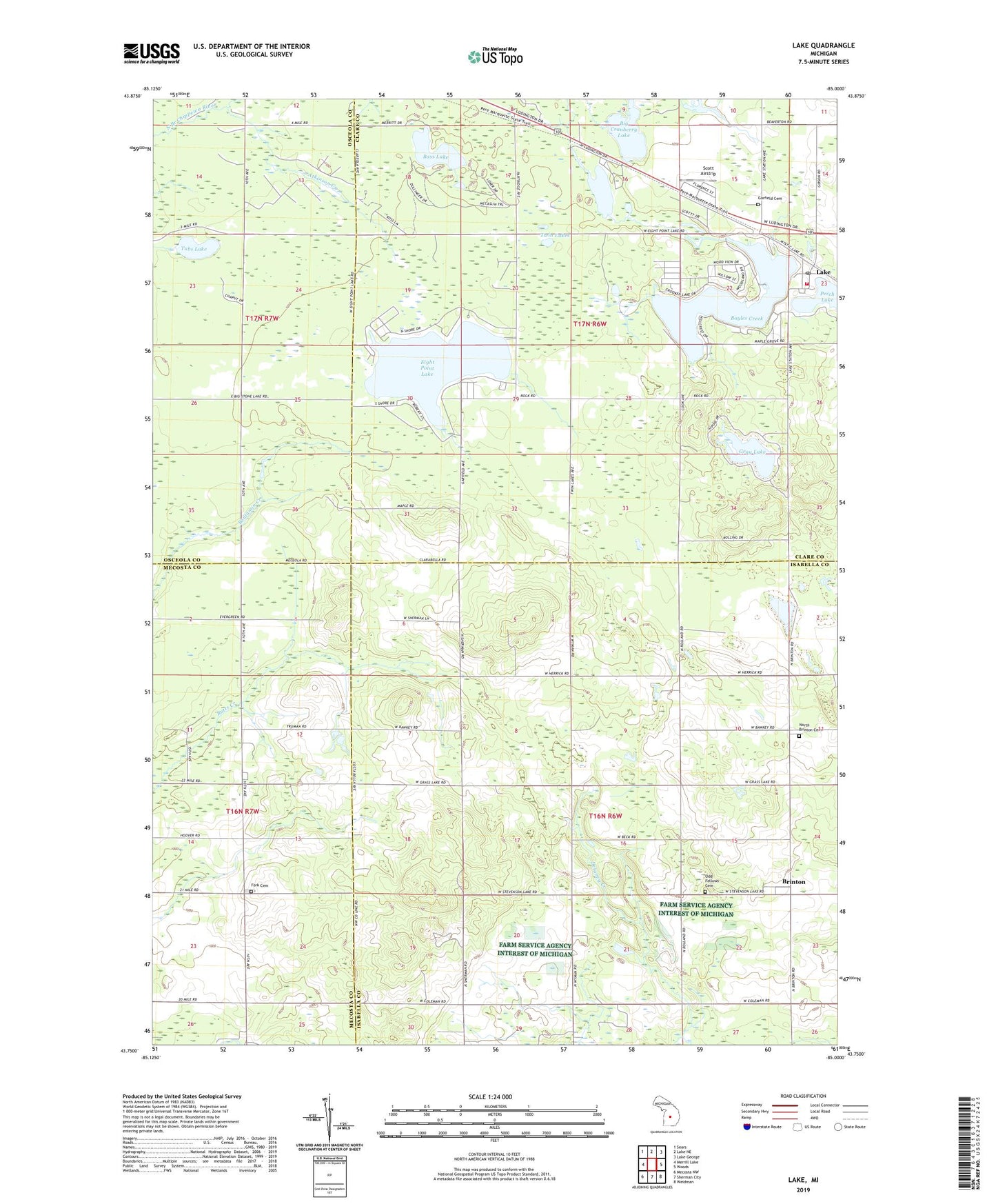
2019 topographic map quadrangle Lake in the state of Michigan. Scale: 1:24000. Based on the newly updated USGS 7.5' US Topo map series, this map is in the following counties: Isabella, Clare, Mecosta, Osceola. The map contains contour data, water features, and other items you are used to seeing on USGS maps, but also has updated roads and other features. This is the next generation of topographic maps. Printed on high-quality waterproof paper with UV fade-resistant inks.
Quads adjacent to this one:
West: Merrill Lake
Northwest: Sears
North: Lake NE
Northeast: Lake George
East: Woods
Southeast: Weidman
South: Sherman City
Southwest: Mecosta NW
Contains the following named places: Atkinson Creek, Bass Lake, Bethany Baptist Church, Boyles Creek, Brinton, Brinton Post Office, Camp Neyati, Crooked Lake, Delaney Creek, Eight Point Lake, Fork Cemetery, Garfield Cemetery, Garfield Township Fire Department, Gray Lake, Lake, Lake Baptist Church, Lake Post Office, Lake Station, Muir Lake, Mystic Lake, North Brinton Cemetery, Odd Fellows Cemetery, Perch Lake, Rocky Pine Airport, Russell Lake, Scott Airstrip, Township of Coldwater, Township of Garfield, Tubs Lake, Twin Lakes, ZIP Code: 48632