MyTopo
Lake NE Michigan US Topo Map
Couldn't load pickup availability
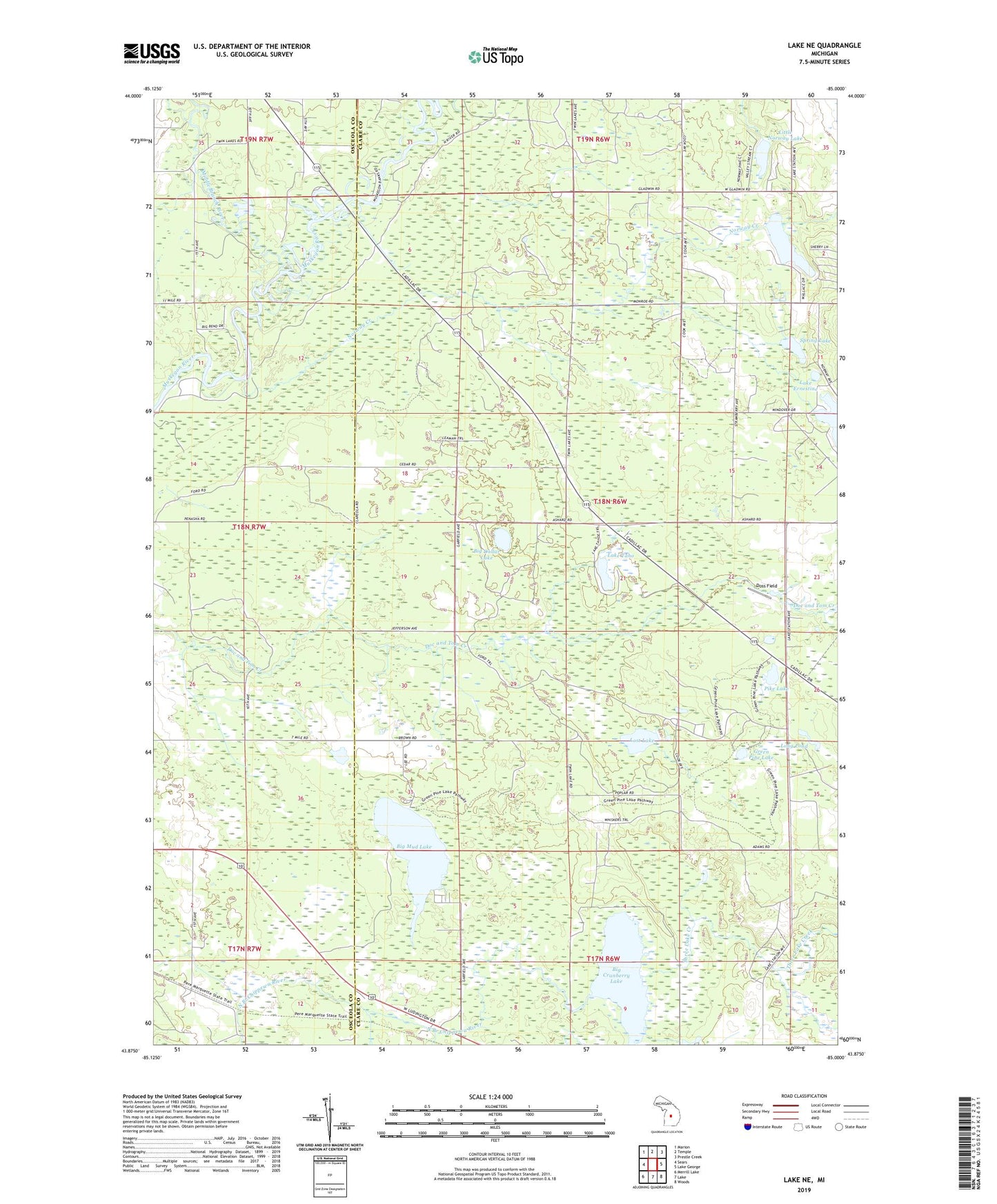
2023 topographic map quadrangle Lake NE in the state of Michigan. Scale: 1:24000. Based on the newly updated USGS 7.5' US Topo map series, this map is in the following counties: Clare, Osceola. The map contains contour data, water features, and other items you are used to seeing on USGS maps, but also has updated roads and other features. This is the next generation of topographic maps. Printed on high-quality waterproof paper with UV fade-resistant inks.
Quads adjacent to this one:
West: Sears
Northwest: Marion
North: Temple
Northeast: Prestle Creek
East: Lake George
Southeast: Woods
South: Lake
Southwest: Merrill Lake
This map covers the same area as the classic USGS quad with code o43085h1.
Contains the following named places: Big Cranberry Lake, Big Dollar Lake, Big Mud Lake, Big Norway Lake, Chippewa, Chippewa Station, Chippewa Station Post Office, Currey Lake, David Helm Chapel, Doss Field, Green Pine Lake, Lake Ernestine, Lake Taho, Little Norway Lake, Long Pond, Lost Lake, Lost Lake Camp, Martin School, Middle Branch River, Mud Lake State Forest Campground, Norway Creek, Pike Lake, Spring Lake, Three Lake Creek, Township of Freeman, Wood Lake