MyTopo
Woods Michigan US Topo Map
Couldn't load pickup availability
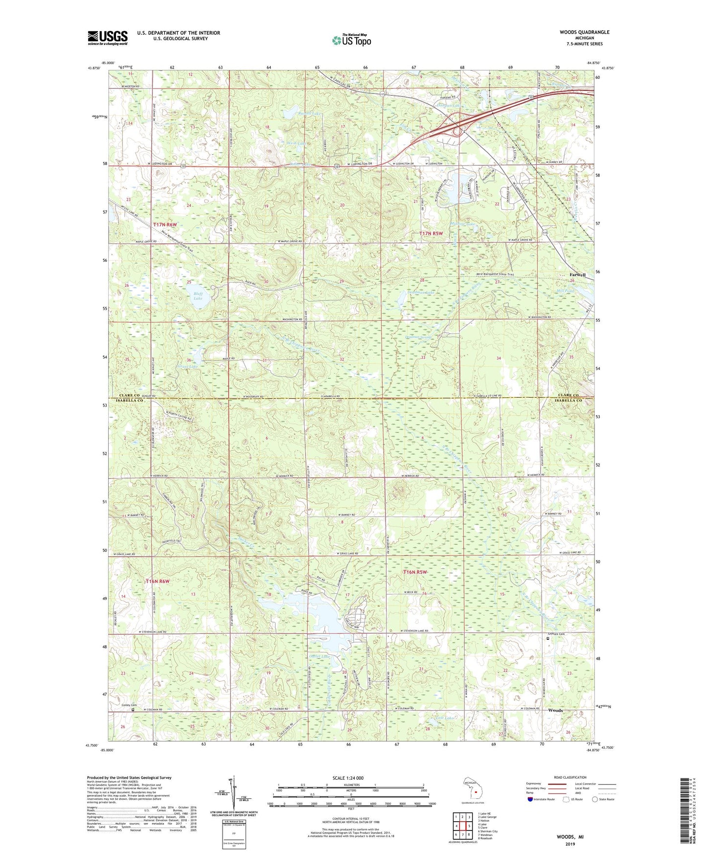
2023 topographic map quadrangle Woods in the state of Michigan. Scale: 1:24000. Based on the newly updated USGS 7.5' US Topo map series, this map is in the following counties: Isabella, Clare. The map contains contour data, water features, and other items you are used to seeing on USGS maps, but also has updated roads and other features. This is the next generation of topographic maps. Printed on high-quality waterproof paper with UV fade-resistant inks.
Quads adjacent to this one:
West: Lake
Northwest: Lake NE
North: Lake George
Northeast: Hatton
East: Clare
Southeast: Rosebush
South: Weidman
Southwest: Sherman City
This map covers the same area as the classic USGS quad with code o43084g8.
Contains the following named places: Bass Lake, Bluff Lake, Coldwater Township Park, Conley Cemetery, Deadman Lake, Deadman Swamp, Dishpan Lake, Dollar Lake, Elm Creek, Farwell Lookout Tower, Gilmore Cemetery, Gilmore Church, Grass Lake, Littlefield Lake, Living Hope Lutheran Church, Lost Lake, Maple Grove Church, Mill Pond, Minnow Lake, North Woods Nursing Center, Outlet Lake, Overton Creek, Russell Lake, Sucker Creek, Sucker Lake, Surrey Lake, Tower Lake, Township of Gilmore, Township of Surrey, Trinity Baptist Church, We-E Lake, Woods, ZIP Code: 48622