MyTopo
Munuscong NE Michigan US Topo Map
Couldn't load pickup availability
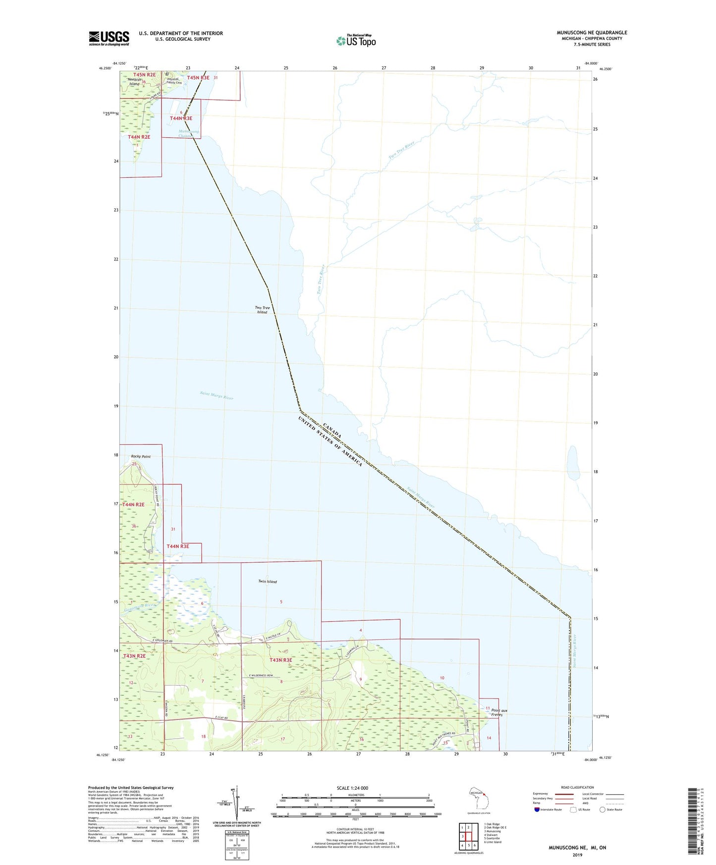
2023 topographic map quadrangle Munuscong NE in the state of Michigan. Scale: 1:24000. Based on the newly updated USGS 7.5' US Topo map series, this map is in the following counties: Chippewa. The map contains contour data, water features, and other items you are used to seeing on USGS maps, but also has updated roads and other features. This is the next generation of topographic maps. Printed on high-quality waterproof paper with UV fade-resistant inks.
Quads adjacent to this one:
West: Munuscong
Northwest: Oak Ridge
North: Oak Ridge OE E
Southeast: Lime Island
South: Goetzville
Southwest: Stalwart
This map covers the same area as the classic USGS quad with code o46084b1.
Contains the following named places: Gogomain River, Johnston Family Cemetery, Johnston Homesite Historical Marker, LeJas Resort Ramp, North Raber School, Point aux Frenes, Rocky Point, Twin Island, Two Tree Island