MyTopo
Little Todd Harbor Michigan US Topo Map
Couldn't load pickup availability
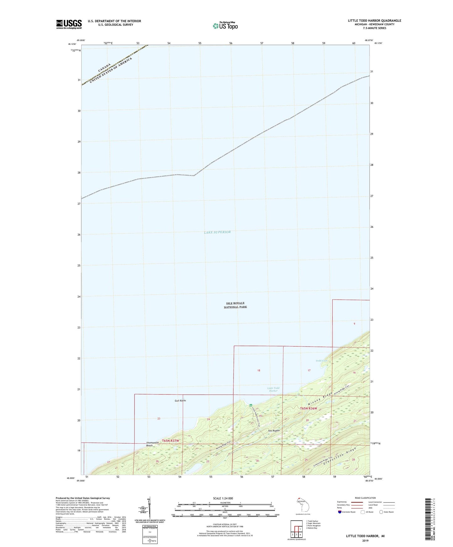
2023 topographic map quadrangle Little Todd Harbor in the state of Michigan. Scale: 1:24000. Based on the newly updated USGS 7.5' US Topo map series, this map is in the following counties: Keweenaw. The map contains contour data, water features, and other items you are used to seeing on USGS maps, but also has updated roads and other features. This is the next generation of topographic maps. Printed on high-quality waterproof paper with UV fade-resistant inks.
Quads adjacent to this one:
East: Todd Harbor
Southeast: Malone Bay
South: Point Houghton
Southwest: Sugar Mountain
This map covers the same area as the classic USGS quad with code o47088h8.
Contains the following named places: Gull Rocks, Little Todd Campground, Little Todd Harbor, Minong Ridge Fire Manway, Minong Ridge Trail, Thomsonite Beach, Todd Cove