MyTopo
Merrill Michigan US Topo Map
Couldn't load pickup availability
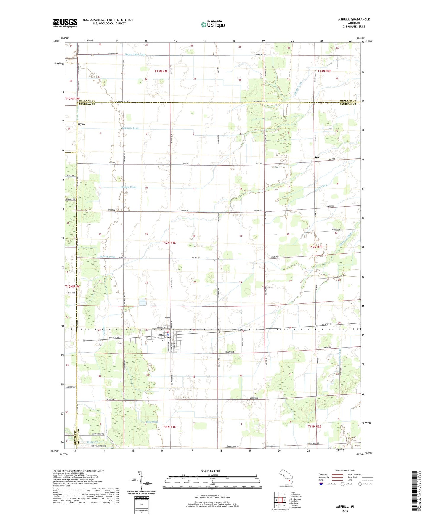
2019 topographic map quadrangle Merrill in the state of Michigan. Scale: 1:24000. Based on the newly updated USGS 7.5' US Topo map series, this map is in the following counties: Saginaw, Midland, Gratiot. The map contains contour data, water features, and other items you are used to seeing on USGS maps, but also has updated roads and other features. This is the next generation of topographic maps. Printed on high-quality waterproof paper with UV fade-resistant inks.
Quads adjacent to this one:
West: Breckenridge
Northwest: Floyd
North: Gordonville
Northeast: Midland South
East: Hemlock
Southeast: Saint Charles
South: Lakefield
Southwest: Rathbone
Contains the following named places: Congregational Christian Church, Corbat Drain, Greison Drain, Handy Creek, Iva, Iva Post Office, Jam, Jam Post Office, Jonesfield - Lakefield Fire Department, Jonesfield Township Hall, Kennedy Drain, Lake of Dreams Campground, Meridian Station, Merrill, Merrill Church, Merrill District Library, Merrill Elementary School, Merrill High School, Merrill Middle School, Merrill Post Office, Merrill Station, Mount Haley Drain, Price Drain, Randall Post Office, Richland Township Police Department Substation, Ryan, Sacred Heart Church, Saint Patrick Ryan Church, Stanton Drain, Township of Jonesfield, Village of Merrill, West's Mill Post Office, Whitmore Drain, Wilson Drain, Wright Drain, Zeitler Airport, Zion Lutheran Church, Zion Lutheran School, ZIP Code: 48637