MyTopo
Argyle Michigan US Topo Map
Couldn't load pickup availability
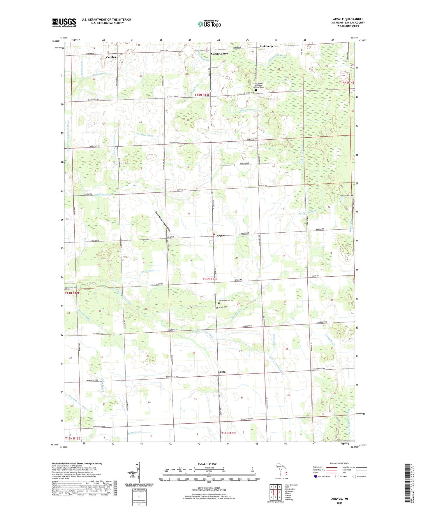
2023 topographic map quadrangle Argyle in the state of Michigan. Scale: 1:24000. Based on the newly updated USGS 7.5' US Topo map series, this map is in the following counties: Sanilac. The map contains contour data, water features, and other items you are used to seeing on USGS maps, but also has updated roads and other features. This is the next generation of topographic maps. Printed on high-quality waterproof paper with UV fade-resistant inks.
Quads adjacent to this one:
West: Shabbona
Northwest: New Greenleaf
North: Ubly
Northeast: Minden City
East: Palms
Southeast: Sandusky
South: Snover
Southwest: Decker
This map covers the same area as the classic USGS quad with code o43082e8.
Contains the following named places: Argyle, Argyle Cemetery, Argyle Drain, Argyle Post Office, Argyle School, Argyle Township Fire Department, Argyle United Methodist Church, Austin Center, Brice Wightman Drain, Brown Drain, Carson Drain, Cumber, Cumber Post Office, Flannery Drain, Franzel Drain, Freiburgers Post Office, Freidberger, Hartel Drain, Hawksworth Drain, Hobbs Drain, Ingles Drain, Laing, Laing Post Office, Laing School, Lutheran Cemetery, Main Hartel Drain, McBride School, McIntyre Drain, Saint Joseph and Saint Ignatius' Cemetery, Saint Joseph's and Saint Ignatius Church, Sanderson Drain, South Branch, South Branch Ingles Draw, Starr School, Swan Drain, Township of Argyle, Wheatland Cemetery, Wheeler Drain, Wheeler School, ZIP Code: 48472