MyTopo
Oak Ridge Michigan US Topo Map
Couldn't load pickup availability
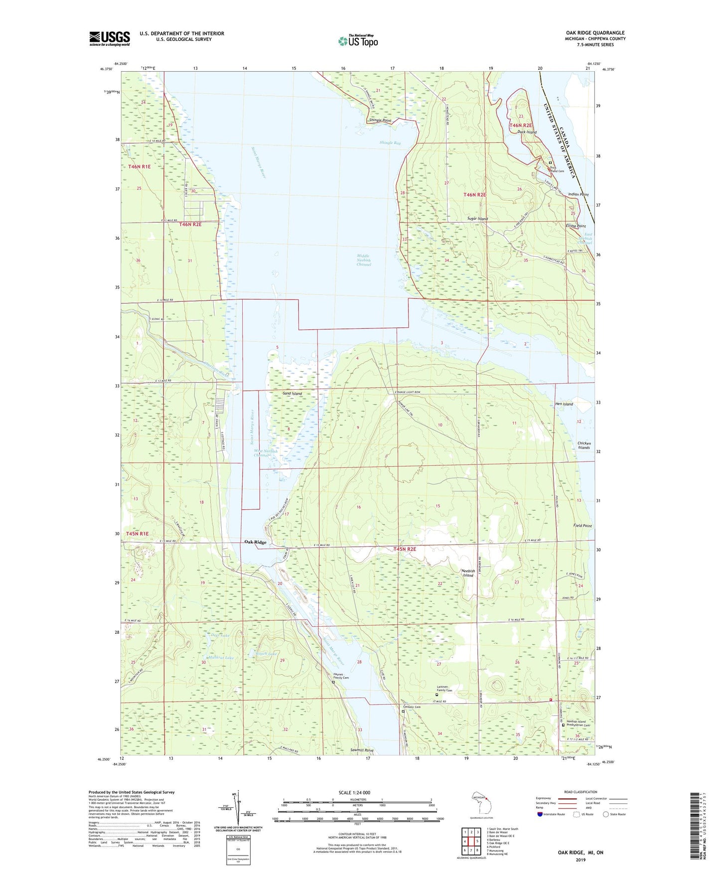
2023 topographic map quadrangle Oak Ridge in the state of Michigan. Scale: 1:24000. Based on the newly updated USGS 7.5' US Topo map series, this map is in the following counties: Chippewa. The map contains contour data, water features, and other items you are used to seeing on USGS maps, but also has updated roads and other features. This is the next generation of topographic maps. Printed on high-quality waterproof paper with UV fade-resistant inks.
Quads adjacent to this one:
West: Barbeau
North: Baie de Wasai
Northeast: Baie de Wasai OE E
East: Oak Ridge OE E
Southeast: Munuscong NE
South: Munuscong
Southwest: Pickford
This map covers the same area as the classic USGS quad with code o46084c2.
Contains the following named places: Charlotte River, Chicken Islands, Deer Lake, Duck Island, Duck Island Cemetery, Duck Lake, Dunbar Forest Experiment Station Michigan State University, Dunbar Park, East Neebish Channel, Elisha Point, Field Point, Franklin's Airport, Haynes Family Cemetery, Hen Island, Indian Point, Laitinen Family Cemetery, Lower Nicolet Ranges, Middle Neebish Channel, Middle Neebish Channel Range, Muskrat Lake, Neebish Island, Neebish Island Catholic Cemetery, Neebish Island Presbyterian Church Cemetery, Neebish Island Volunteer Fire Department, Oak Ridge, Oak Ridge Park Post Office, Oak Ridge Park School, Roach Lake, Sand Island, Shingle Bay, Shingle Point, Stone School District Number 4, Township of Soo, West Neebish Channel, West Neebish Channel Range, West Noebish Channel Upper Range, ZIP Code: 49710