MyTopo
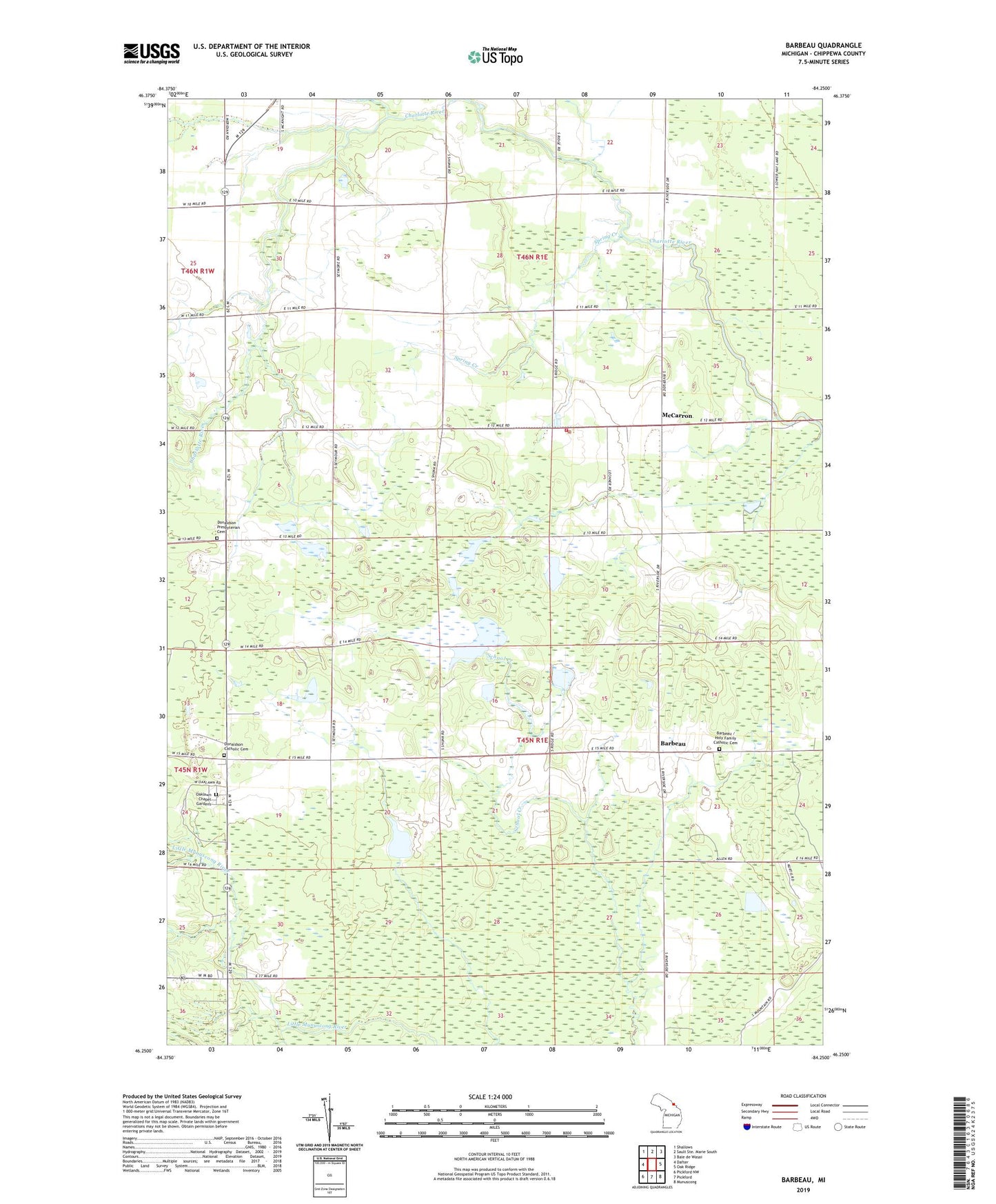
Barbeau Michigan US Topo Map
Couldn't load pickup availability
2023 topographic map quadrangle Barbeau in the state of Michigan. Scale: 1:24000. Based on the newly updated USGS 7.5' US Topo map series, this map is in the following counties: Chippewa. The map contains contour data, water features, and other items you are used to seeing on USGS maps, but also has updated roads and other features. This is the next generation of topographic maps. Printed on high-quality waterproof paper with UV fade-resistant inks.
Quads adjacent to this one:
West: Dafter
Northwest: Shallows
Northeast: Baie de Wasai
East: Oak Ridge
Southeast: Munuscong
South: Pickford
Southwest: Pickford NW
This map covers the same area as the classic USGS quad with code o46084c3.
Contains the following named places: Barbeau, Barbeau / Holy Family Catholic Cemetery, Barbeau Post Office, Barbeau Tower, Bruce Township Volunteer Fire Department, Corktown School, Donaldson, Donaldson Catholic Cemetery, Donaldson Post Office, Donaldson Presbyterian Cemetery, Donaldson Presbyterian Church, East McCarron School, Holy Family Church, McCarron, McCarron Church, McCarron Post Office, Oaklawn Chapel Gardens, Spring Creek, Township of Bruce