MyTopo
Omer SW Michigan US Topo Map
Couldn't load pickup availability
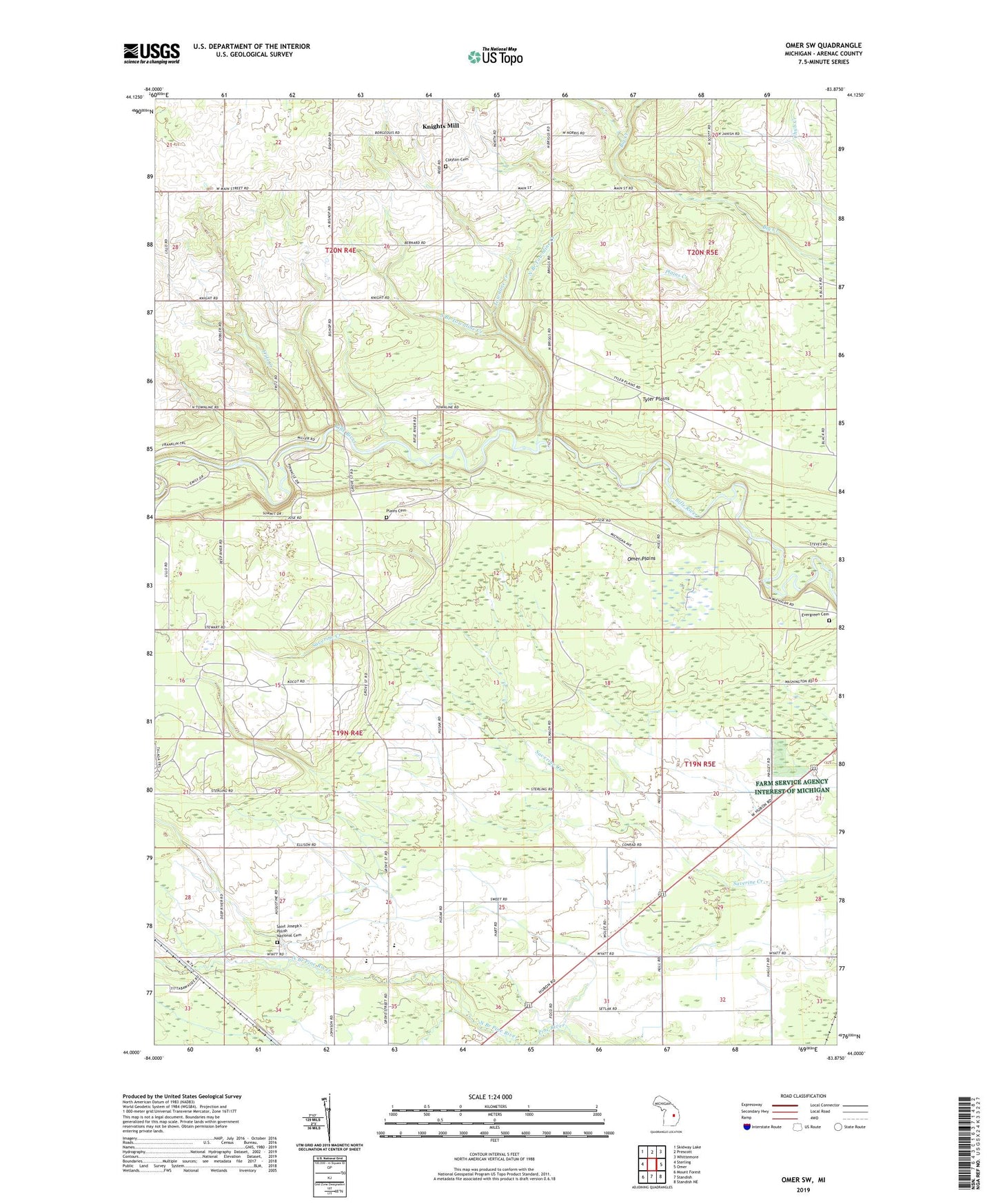
2023 topographic map quadrangle Omer SW in the state of Michigan. Scale: 1:24000. Based on the newly updated USGS 7.5' US Topo map series, this map is in the following counties: Arenac. The map contains contour data, water features, and other items you are used to seeing on USGS maps, but also has updated roads and other features. This is the next generation of topographic maps. Printed on high-quality waterproof paper with UV fade-resistant inks.
Quads adjacent to this one:
West: Sterling
Northwest: Skidway Lake
North: Prescott
Northeast: Whittemore
East: Omer
Southeast: Standish NE
South: Standish
Southwest: Mount Forest
This map covers the same area as the classic USGS quad with code o44083a8.
Contains the following named places: Assembly of God Church, Clayton Cemetery, Crystal Creek Campground, Deep River Gas and Oil Field, Deep River Station, Deepriver Post Office, Evergreen Cemetery, Fritz Creek, Knights Mill, Melita Church, North Branch Pine River, North Branch Townline Creek, Omer Plains, Plains Cemetery, Saint Edwards Catholic Cemetery, Saint Joseph's Polish National Cemetery, South Branch Townline Creek, Standish-Sterling High School, Townline Creek, Township of Clayton, Township of Deep River, Tyler Plains, ZIP Code: 48749