MyTopo
Omer Michigan US Topo Map
Couldn't load pickup availability
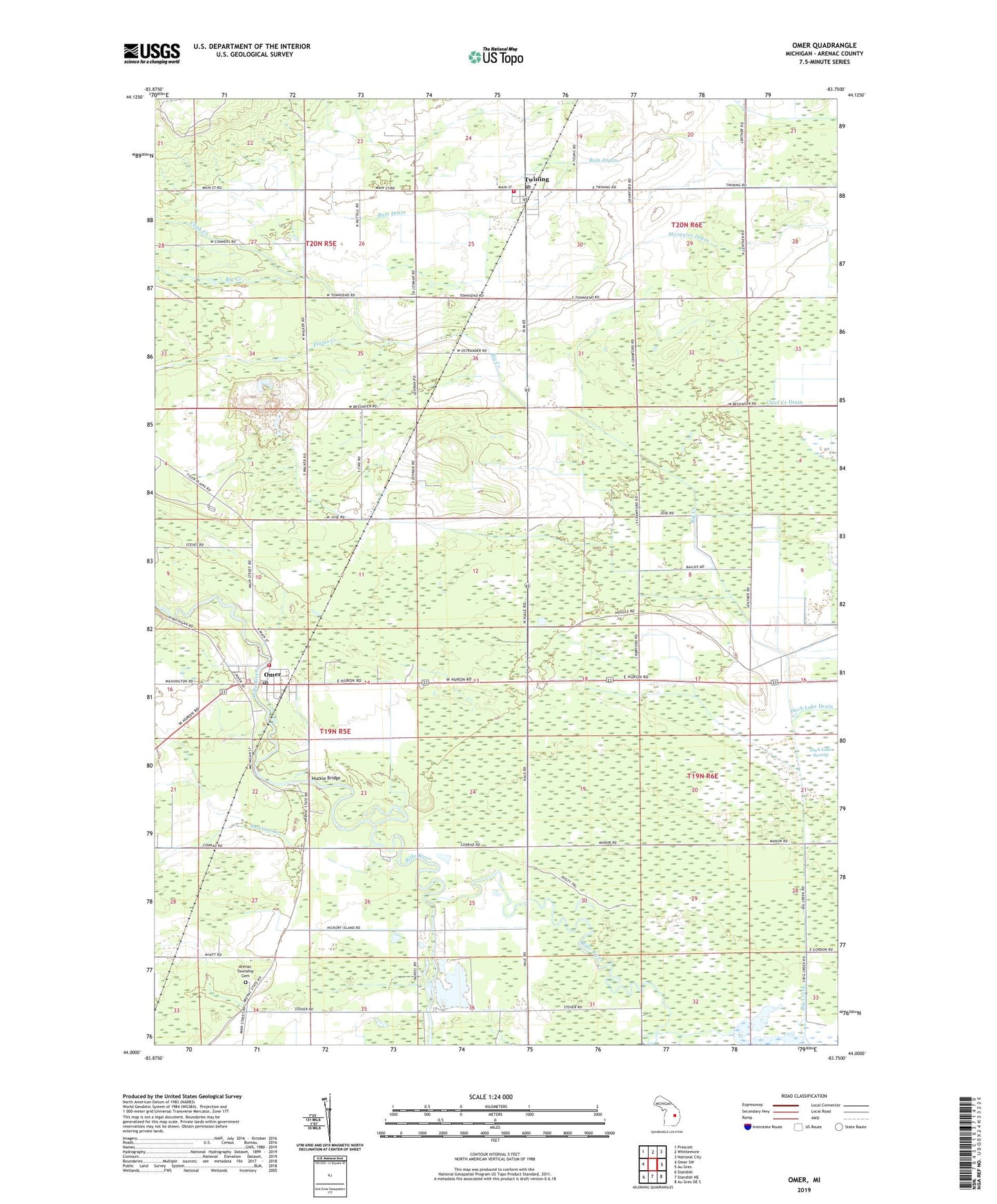
2023 topographic map quadrangle Omer in the state of Michigan. Scale: 1:24000. Based on the newly updated USGS 7.5' US Topo map series, this map is in the following counties: Arenac. The map contains contour data, water features, and other items you are used to seeing on USGS maps, but also has updated roads and other features. This is the next generation of topographic maps. Printed on high-quality waterproof paper with UV fade-resistant inks.
Quads adjacent to this one:
West: Omer SW
Northwest: Prescott
North: Whittemore
Northeast: National City
East: Au Gres
Southeast: Au Gres OE S
South: Standish NE
Southwest: Standish
This map covers the same area as the classic USGS quad with code o44083a7.
Contains the following named places: Arenac, Arenac Eastern High School, Arenac Post Office, Arenac Township Cemetery, Big Bend Family Campground, Chub Creek, City of Omer, Duck Lake Drain, Huckle Bridge, Knoll View Golf Course, Omer, Omer - Arenac Township Fire Department, Omer Library, Omer Masonic Hall Historical Marker, Omer Post Office, Omer Quarry, Omer Station, Plains Creek, Reorganized Church of Jesus Christ of Latter Day Saints, Riverbend Campground and Canoe Rental, Russell's Canoes and Campgrounds, Saverine Creek, Township of Arenac, Township of Mason, Trinity United Methodist Church, Turner Township Hall, Twining, Twining - Turner - Mason Fire Department, Twining Baptist Church, Twining Post Office, Twining Station, Village of Twining, ZIP Code: 48766