MyTopo
Otter Lake Michigan US Topo Map
Couldn't load pickup availability
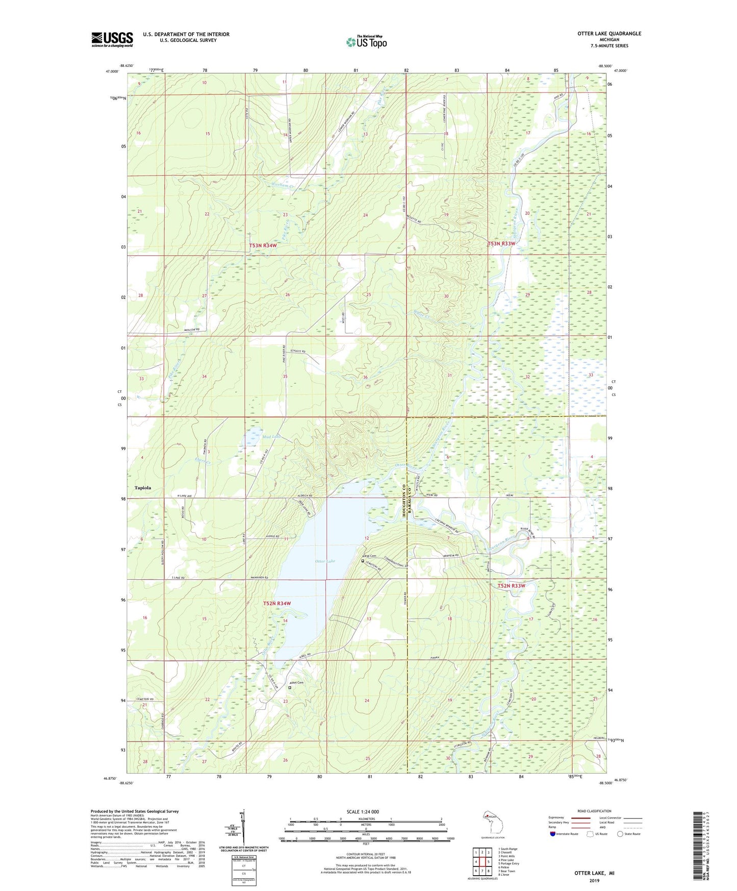
2023 topographic map quadrangle Otter Lake in the state of Michigan. Scale: 1:24000. Based on the newly updated USGS 7.5' US Topo map series, this map is in the following counties: Houghton, Baraga. The map contains contour data, water features, and other items you are used to seeing on USGS maps, but also has updated roads and other features. This is the next generation of topographic maps. Printed on high-quality waterproof paper with UV fade-resistant inks.
Quads adjacent to this one:
West: Pine Lake
Northwest: South Range
North: Chassell
Northeast: Point Mills
East: Portage Entry
South: Bear Town
Southwest: Pelkie
This map covers the same area as the classic USGS quad with code o46088h5.
Contains the following named places: Askel, Askel Cemetery, Askel Post Office, Kargi Cemetery, Mud Lake, Otter Lake, Otter Lake Lookout Tower, Otter River, Pike River Landing, Tapiola Apostolic Lutheran Church, Township of Chassell, White Creek, Worham Creek, ZIP Code: 49916