MyTopo
Ovid West Michigan US Topo Map
Couldn't load pickup availability
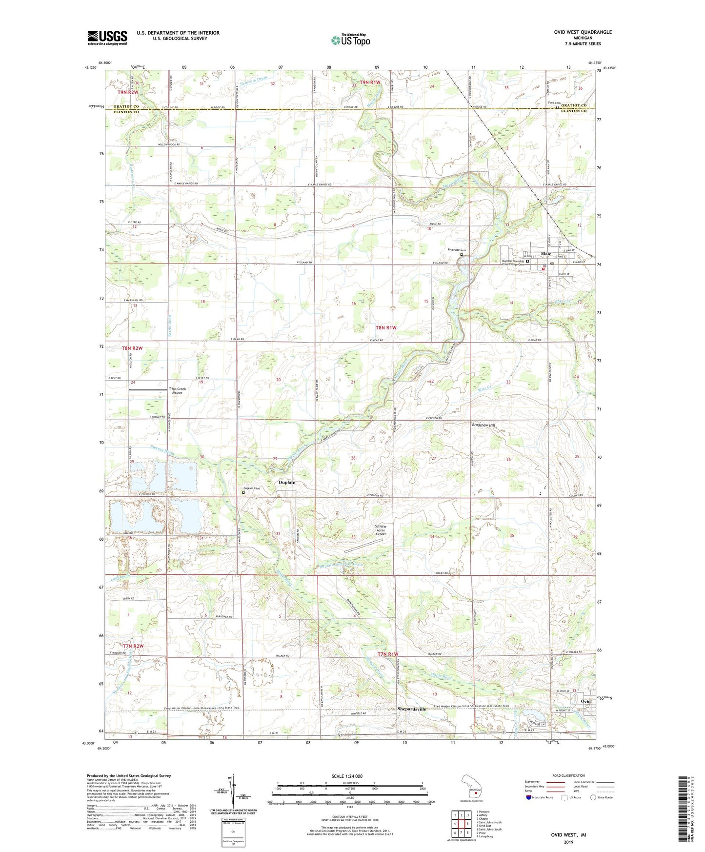
2019 topographic map quadrangle Ovid West in the state of Michigan. Scale: 1:24000. Based on the newly updated USGS 7.5' US Topo map series, this map is in the following counties: Clinton, Gratiot. The map contains contour data, water features, and other items you are used to seeing on USGS maps, but also has updated roads and other features. This is the next generation of topographic maps. Printed on high-quality waterproof paper with UV fade-resistant inks.
Quads adjacent to this one:
West: Saint Johns North
Northwest: Pompeii
North: Ashley
Northeast: Chapin
East: Ovid East
Southeast: Laingsburg
South: Price
Southwest: Saint Johns South
Contains the following named places: A and M Farms, A and S Farms, Al Jo Farms, Alder Creek Drain, Baker Creek, Barrio Ditch, Bear Foote Farm, Bernath Farm, Bradshaw Hill, Calvary Church, Duplain, Duplain and Ovid Drain, Duplain Cemetery, Duplain Church of Christ, Duplain Post Office, Duplain Township Elsie Village Cemetery, E B Ridge Dairy, EE Knight Elementary School, Elsie, Elsie Area Ambulance Service, Elsie Area Fire Department and Rescue, Elsie Family Health Care Center, Elsie Police Department, Elsie Post Office, Elsie Public Library, Elsie Station, Elsie Village Hall, Fabus Farms, Fenmore Baptist Church, Ford Cemetery, Kiesling Farms, Kurncz Farms, Lakeside Golf Course, Little Maple River, Mae Shady Nursery, Maple Valley Farms, Nash Farms, Ovid-Elsie High School, Peck Farms, Reha Farms, Riverside Cemetery, Rochester Colony Historical Marker, Rochester Lake, Schiffer Acres Airport, Shepardsville, Shepardsville Post Office, Shepardsville United Methodist Church, Shephardsville Station, Stevens Drain, Sturgis Drain, Taylor Farm, Township of Duplain, Tripp Creek Airport, United Methodist Church, Village of Elsie, Wadell Farms, Wise Creek, WoeS-FM (Ovid-Elsie)