MyTopo
Pompeii Michigan US Topo Map
Couldn't load pickup availability
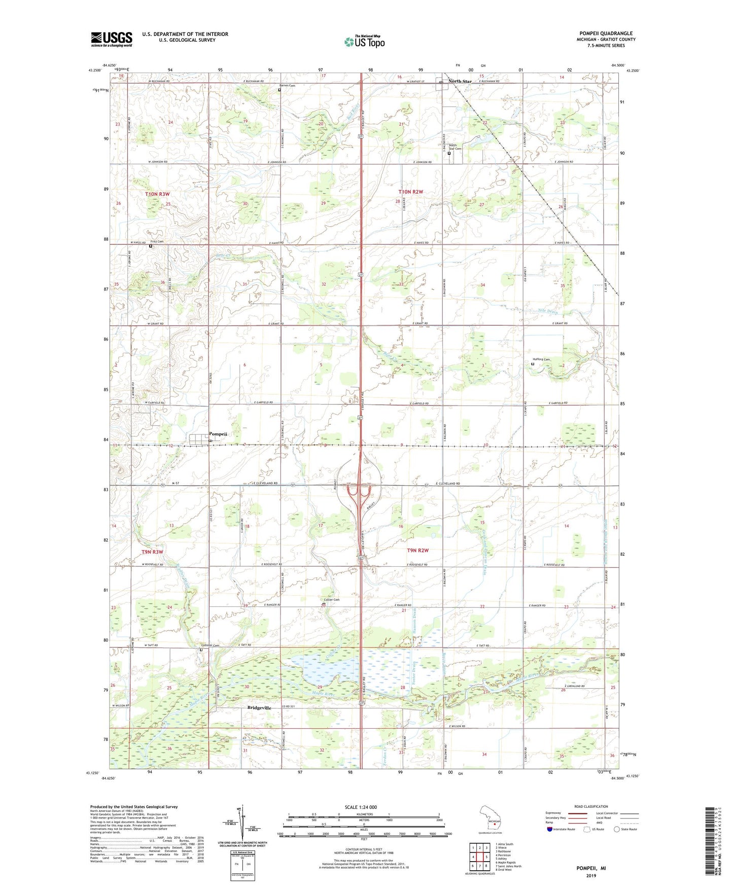
2023 topographic map quadrangle Pompeii in the state of Michigan. Scale: 1:24000. Based on the newly updated USGS 7.5' US Topo map series, this map is in the following counties: Gratiot. The map contains contour data, water features, and other items you are used to seeing on USGS maps, but also has updated roads and other features. This is the next generation of topographic maps. Printed on high-quality waterproof paper with UV fade-resistant inks.
Quads adjacent to this one:
West: Perrinton
Northwest: Alma South
North: Ithaca
Northeast: Rathbone
East: Ashley
Southeast: Ovid West
South: Saint Johns North
Southwest: Maple Rapids
This map covers the same area as the classic USGS quad with code o43084b5.
Contains the following named places: Barnes Cemetery, Bethel Chapel, Bowen and Brown Drain, Boyce Drain, Bradley Drain, Bridgeville, Bridgeville Post Office, Collier Cemetery, Collier Creek, Collister Cemetery, Cook and Duncan Drain, East Washington Church, Ferdon Creek, Foster Drain, Fritz Cemetery, Hanson Drain, Hufford Cemetery, Nile Drain, North Star, North Star Cemetery, North Star Country Club, North Star Post Office, North Star Station, Ola, Ola Church, Ola Post Office, Ola School, Ola Station, Pompeii, Pompeii Post Office, Pompeii Station, Reed Park, Township of North Star, Township of Washington, United Methodist Church, Washington Center School, ZIP Codes: 48806, 48874